File:NPS voyageurs-kab-ash-trail-map.gif

Size of this preview: 776 × 600 pixels. Other resolutions: 311 × 240 pixels | 621 × 480 pixels | 994 × 768 pixels | 1,100 × 850 pixels.
Original file (1,100 × 850 pixels, file size: 109 KB, MIME type: image/gif, 0.1 s)
Captions
Captions
Add a one-line explanation of what this file represents
Summary
edit
| Description |
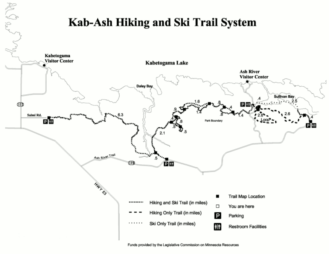
English: Kab-Ash Trail map, showing the entire length of the trail from the Ash River area to the Kabetogama Lake Visitor Center area. This map also marks the ski routes open in winter. |
| Date | |
| Source | U.S. National Park Service (http://npmaps.com/wp-content/uploads/voyageurs-kab-ash-trail-map.gif) |
| Author | U.S. National Park Service, restoration/cleanup by Matt Holly |
Licensing
edit
| This image or media file contains material based on a work of a National Park Service employee, created as part of that person's official duties. As a work of the U.S. federal government, such work is in the public domain in the United States. See the NPS website and NPS copyright policy for more information. |
File history
Click on a date/time to view the file as it appeared at that time.
| Date/Time | Thumbnail | Dimensions | User | Comment | |
|---|---|---|---|---|---|
| current | 09:54, 17 May 2017 | | 1,100 × 850 (109 KB) | RKBot (talk | contribs) | =={{int:filedesc}}== {{Information |description= {{en|1=Kab-Ash Trail map, showing the entire length of the trail from the Ash River area to the Kabetogama Lake Visitor Center area. This map also marks the ski routes open in winter.}} |date= 2016-01-23... |
You cannot overwrite this file.
File usage on Commons
The following page uses this file: