File:NPS walnut-canyon-geologic-map.gif

Size of this preview: 800 × 529 pixels. Other resolutions: 320 × 212 pixels | 640 × 423 pixels | 1,024 × 677 pixels | 1,280 × 847 pixels | 2,560 × 1,693 pixels | 3,858 × 2,552 pixels.
Original file (3,858 × 2,552 pixels, file size: 589 KB, MIME type: image/gif, 0.1 s)
Captions
Captions
Add a one-line explanation of what this file represents
Summary edit
| Description |
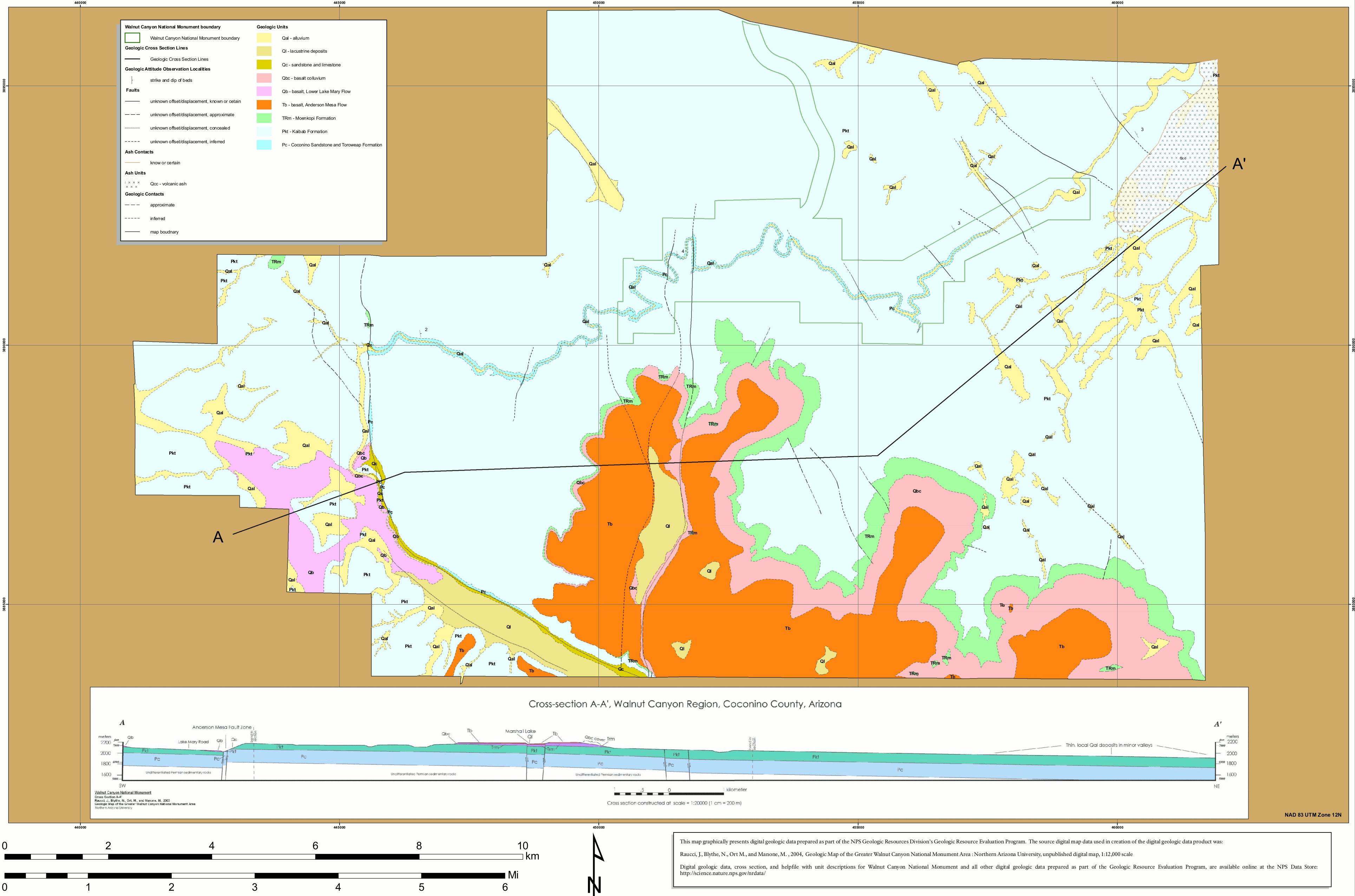
English: Walnut Canyon geologic map, labeling the rock units that make up the park lands. A cross-section is also provided to show the rock layers’ underground orientation. |
| Date | |
| Source | U.S. National Park Service (http://npmaps.com/wp-content/uploads/walnut-canyon-geologic-map.gif) |
| Author | U.S. National Park Service, restoration/cleanup by Matt Holly |
Licensing edit
| This image or media file contains material based on a work of a National Park Service employee, created as part of that person's official duties. As a work of the U.S. federal government, such work is in the public domain in the United States. See the NPS website and NPS copyright policy for more information. |
File history
Click on a date/time to view the file as it appeared at that time.
| Date/Time | Thumbnail | Dimensions | User | Comment | |
|---|---|---|---|---|---|
| current | 09:56, 17 May 2017 | | 3,858 × 2,552 (589 KB) | RKBot (talk | contribs) | =={{int:filedesc}}== {{Information |description= {{en|1=Walnut Canyon geologic map, labeling the rock units that make up the park lands. A cross-section is also provided to show the rock layers’ underground orientation.}} |date= 2017-05-07 |source= U... |
You cannot overwrite this file.
File usage on Commons
The following page uses this file: