File:NPS wrangell-st-elias-nabesna-road-map.jpg
Size of this preview: 788 × 600 pixels. Other resolutions: 315 × 240 pixels | 631 × 480 pixels | 1,009 × 768 pixels | 1,344 × 1,023 pixels.
Original file (1,344 × 1,023 pixels, file size: 441 KB, MIME type: image/jpeg)
Captions
Captions
Add a one-line explanation of what this file represents
Summary edit
| Description |
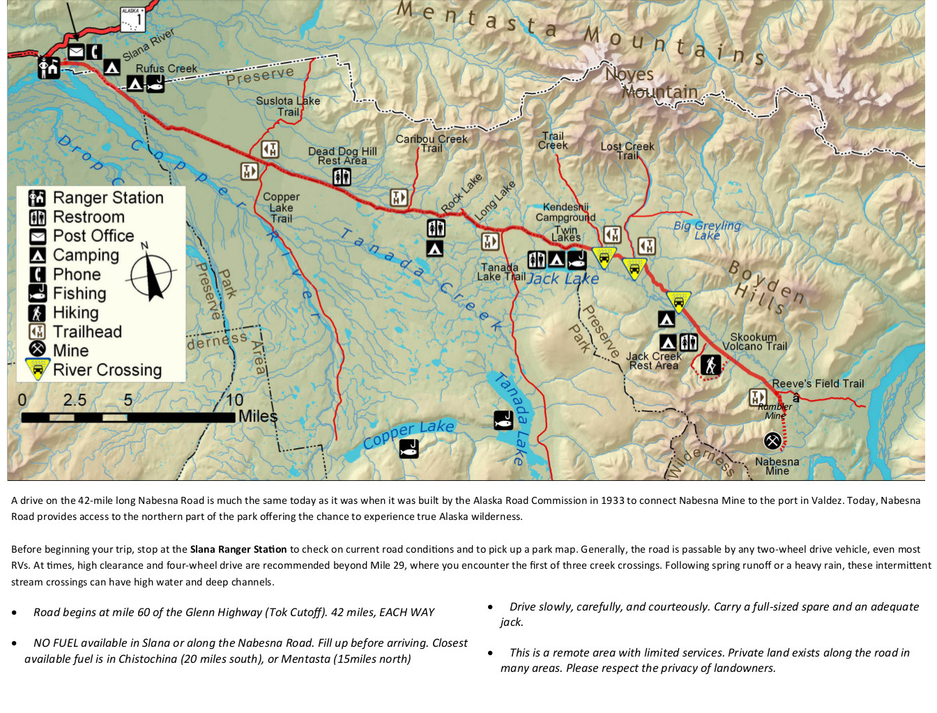
English: The Nabesna Road map from newspaper shows the other maintained road inside the park, allowing you to access the northern part of the park. Labeled are ranger stations, restrooms, camping, and more. |
| Date | |
| Source | U.S. National Park Service (http://npmaps.com/wp-content/uploads/wrangell-st-elias-nabesna-road-map.jpg) |
| Author | U.S. National Park Service, restoration/cleanup by Matt Holly |
Licensing edit
| This image or media file contains material based on a work of a National Park Service employee, created as part of that person's official duties. As a work of the U.S. federal government, such work is in the public domain in the United States. See the NPS website and NPS copyright policy for more information. |
File history
Click on a date/time to view the file as it appeared at that time.
| Date/Time | Thumbnail | Dimensions | User | Comment | |
|---|---|---|---|---|---|
| current | 10:02, 17 May 2017 | | 1,344 × 1,023 (441 KB) | RKBot (talk | contribs) | =={{int:filedesc}}== {{Information |description= {{en|1=The Nabesna Road map from newspaper shows the other maintained road inside the park, allowing you to access the northern part of the park. Labeled are ranger stations, restrooms, camping, and more... |
You cannot overwrite this file.
File usage on Commons
The following 3 pages use this file:
File usage on other wikis
The following other wikis use this file:
- Usage on de.wikipedia.org