File:NSG Tideweser Hochwasser Rechtebe 2.jpg

Size of this preview: 800 × 600 pixels. Other resolutions: 320 × 240 pixels | 640 × 480 pixels | 1,024 × 768 pixels | 1,280 × 960 pixels | 2,560 × 1,920 pixels | 5,184 × 3,888 pixels.
Original file (5,184 × 3,888 pixels, file size: 5.99 MB, MIME type: image/jpeg)
Captions
Captions
River Weser ( right sidearm ) NSG Tideweser GPS-Daten 53.30966°N 8.51529°E
Summary edit
| Description |
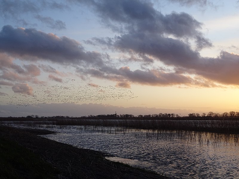
Deutsch: Weser (Rechter Nebenarm) NSG Tideweser bei Hochwasser, das Wasser steht ca. 50 cm unter der Deichkrone des Sommerdeiches, am Himmel Gänseschwärme. Blickrichtung Rade
English: River Weser ( right sidearm ) NSG Tideweser in case of high water. The water is about 50cm below the top oft he dike. Flocks of goose in the sky. Line of sight Rade. |
| Date | |
| Source | Own work |
| Author | Dagmar Jeromin |
Licensing edit
I, the copyright holder of this work, hereby publish it under the following license:
This file is licensed under the Creative Commons Attribution-Share Alike 4.0 International license.
- You are free:
- to share – to copy, distribute and transmit the work
- to remix – to adapt the work
- Under the following conditions:
- attribution – You must give appropriate credit, provide a link to the license, and indicate if changes were made. You may do so in any reasonable manner, but not in any way that suggests the licensor endorses you or your use.
- share alike – If you remix, transform, or build upon the material, you must distribute your contributions under the same or compatible license as the original.
This image was uploaded as part of Wiki Loves Earth 2020.
|
 |
File history
Click on a date/time to view the file as it appeared at that time.
| Date/Time | Thumbnail | Dimensions | User | Comment | |
|---|---|---|---|---|---|
| current | 18:43, 2 May 2020 | | 5,184 × 3,888 (5.99 MB) | Dagmar Jeromin (talk | contribs) | Uploaded own work with UploadWizard |
You cannot overwrite this file.
File usage on Commons
There are no pages that use this file.