File:NWFB30XRtMap.png
Size of this preview: 609 × 600 pixels. Other resolutions: 244 × 240 pixels | 487 × 480 pixels | 780 × 768 pixels | 1,040 × 1,024 pixels | 1,890 × 1,861 pixels.
Original file (1,890 × 1,861 pixels, file size: 320 KB, MIME type: image/png)
Captions
Captions
Add a one-line explanation of what this file represents
Summary edit
| Description |
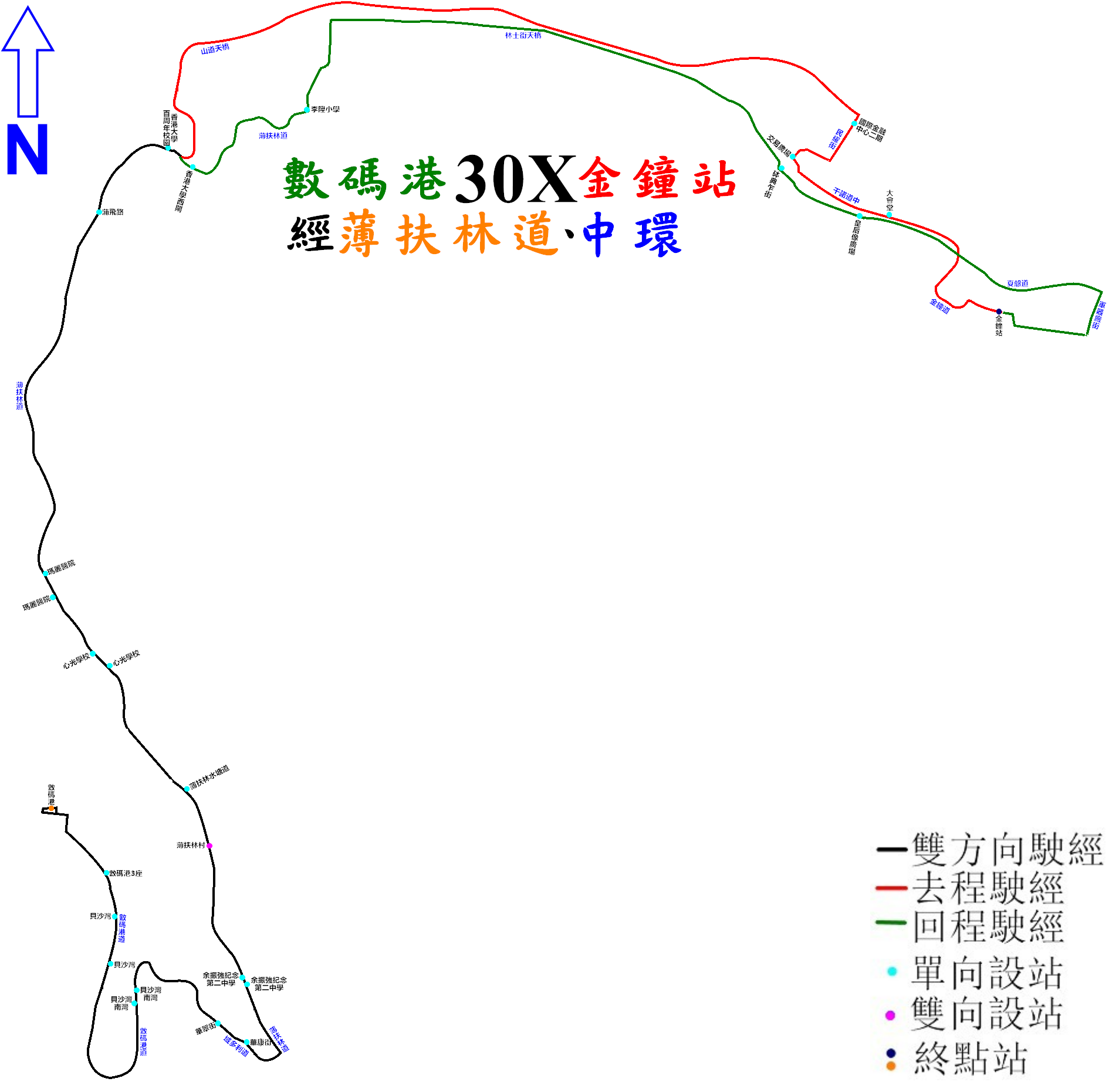
中文(香港):新巴30X線的走線圖 |
| Date | |
| Source | Own work |
| Author | ATR50 |
Licensing edit
I, the copyright holder of this work, hereby publish it under the following license:
This file is licensed under the Creative Commons Attribution-Share Alike 3.0 Unported license.
- You are free:
- to share – to copy, distribute and transmit the work
- to remix – to adapt the work
- Under the following conditions:
- attribution – You must give appropriate credit, provide a link to the license, and indicate if changes were made. You may do so in any reasonable manner, but not in any way that suggests the licensor endorses you or your use.
- share alike – If you remix, transform, or build upon the material, you must distribute your contributions under the same or compatible license as the original.
File history
Click on a date/time to view the file as it appeared at that time.
| Date/Time | Thumbnail | Dimensions | User | Comment | |
|---|---|---|---|---|---|
| current | 04:49, 5 September 2022 | | 1,890 × 1,861 (320 KB) | ATR50~commonswiki (talk | contribs) | 2022年8月28日:延長至金鐘(東),並改為雙向運作 |
| 14:00, 26 June 2019 |  | 800 × 1,080 (305 KB) | ATR50~commonswiki (talk | contribs) | 2019年3月增站 | |
| 17:47, 30 June 2017 |  | 800 × 1,080 (304 KB) | ATR50~commonswiki (talk | contribs) | 2017年6月改良 | |
| 03:06, 9 June 2014 |  | 800 × 949 (246 KB) | ATR50~commonswiki (talk | contribs) | User created page with UploadWizard |
You cannot overwrite this file.
File usage on Commons
The following 13 pages use this file:
- User:Chumwa/OgreBot/Potential transport maps/2017 June 21-30
- User:Chumwa/OgreBot/Potential transport maps/2019 June 21-30
- User:Chumwa/OgreBot/Public transport information/2017 June 21-30
- User:Chumwa/OgreBot/Public transport information/2019 June 21-30
- User:Chumwa/OgreBot/Public transport information/2022 September 1-10
- User:Chumwa/OgreBot/Transport Maps/2017 June 21-30
- User:Chumwa/OgreBot/Transport Maps/2019 June 21-30
- User:Chumwa/OgreBot/Transport Maps/2022 September 1-10
- User:Chumwa/OgreBot/Travel and communication maps/2017 June 21-30
- User:Chumwa/OgreBot/Travel and communication maps/2019 June 21-30
- User:Chumwa/OgreBot/Travel and communication maps/2022 September 1-10
- User:OgreBot/Watercraft/2017 June 30
- User:Pechristener/Bridges/2014 June 1-10
File usage on other wikis
The following other wikis use this file:
- Usage on zh.wikipedia.org