File:Nanaehama eki.jpg

Size of this preview: 600 × 600 pixels. Other resolutions: 240 × 240 pixels | 480 × 480 pixels | 768 × 768 pixels | 1,024 × 1,024 pixels | 1,900 × 1,900 pixels.
Original file (1,900 × 1,900 pixels, file size: 3.4 MB, MIME type: image/jpeg)
Captions
Captions
Add a one-line explanation of what this file represents
Summary
edit
| Description |
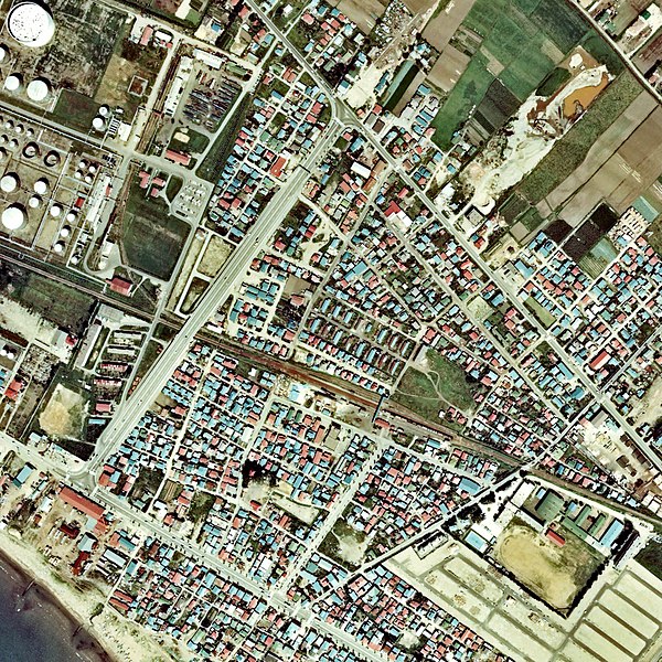
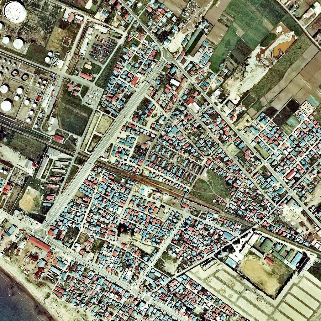
日本語: 江差線 七重浜駅 1976年。周囲約1km範囲。どちらも島状の相対式ホーム2面2線を有し、ホームと駅舎間には貨物積卸線、駅裏には左上のアジア石油(当時)函館製油所向け専用線用の留置線が数本ある。 |
| Date | |
| Source | 国土交通省 国土画像情報(カラー空中写真)を基に作成 |
| Author | Nisanyongo |
| Permission (Reusing this file) |
下記を参照して下さい |
Licensing
edit

|
The copyright holder of this file, the Ministry of Land, Infrastructure, Transport and Tourism of Japan, allows anyone to use it for any purpose, provided that the copyright holder is properly attributed. Redistribution, derivative work, commercial use, and all other use is permitted. |
Attribution:
Copyright © National Land Image Information (Color Aerial Photographs), Ministry of Land, Infrastructure, Transport and Tourism
|
 |
This image is copyrighted by the Ministry of Land, Infrastructure, Transport and Tourism of Japan. For terms of use, see the stipulation to use of National Land Information (in Japanese) and message from MLIT (in Japanese and English). When you display this image on an article, include the following phrase in the description: "Made based on National Land Image Information (Color Aerial Photographs), Ministry of Land, Infrastructure, Transport and Tourism".
|
File history
Click on a date/time to view the file as it appeared at that time.
| Date/Time | Thumbnail | Dimensions | User | Comment | |
|---|---|---|---|---|---|
| current | 11:53, 29 January 2013 | | 1,900 × 1,900 (3.4 MB) | Nisanyongo (talk | contribs) | {{Information |Description=江差線 七重浜駅 1976年。周囲約1km範囲。どちらも島状の相対式ホーム2面2線を有し、ホームと駅舎間には貨物積卸線、駅裏には左上のアジア石油(当時)函館油槽所... |
You cannot overwrite this file.
File usage on Commons
There are no pages that use this file.
File usage on other wikis
The following other wikis use this file:
- Usage on ja.wikipedia.org