File:Nanmadol 2017-07-03 0512Z.jpg

Size of this preview: 461 × 599 pixels. Other resolutions: 185 × 240 pixels | 369 × 480 pixels | 591 × 768 pixels | 788 × 1,024 pixels | 1,576 × 2,048 pixels | 2,672 × 3,472 pixels.
Original file (2,672 × 3,472 pixels, file size: 1.29 MB, MIME type: image/jpeg)
Captions
Captions
Add a one-line explanation of what this file represents
Summary edit
| Description |
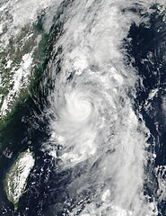
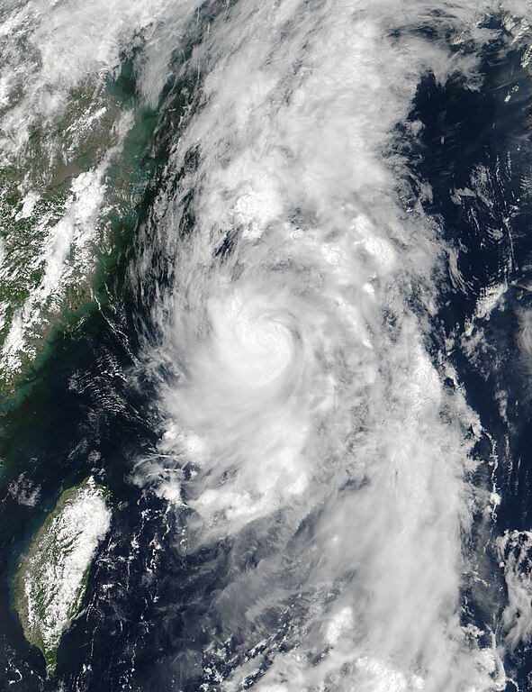
English: Severe Tropical Storm Nanmadol at peak intensity near the Ryukyu Islands on July 3, 2017. |
| Date | |
| Source | Rapid Response - LANCE |
| Author | VIIRS image captured by NASA’s Suomi NPP satellite |
| Camera location | | View this and other nearby images on: OpenStreetMap |
|---|
Licensing edit
| This file is in the public domain in the United States because it was solely created by NASA. NASA copyright policy states that "NASA material is not protected by copyright unless noted". (See Template:PD-USGov, NASA copyright policy page or JPL Image Use Policy.) | ||
 |
Warnings:
|
File history
Click on a date/time to view the file as it appeared at that time.
| Date/Time | Thumbnail | Dimensions | User | Comment | |
|---|---|---|---|---|---|
| current | 10:06, 9 February 2018 | | 2,672 × 3,472 (1.29 MB) | A1Cafel (talk | contribs) | 375m |
| 04:09, 29 January 2018 |  | 2,672 × 3,472 (2.74 MB) | A1Cafel (talk | contribs) | Original | |
| 04:32, 16 July 2017 |  | 2,672 × 3,472 (2.26 MB) | Meow (talk | contribs) | Directly exported from the TIFF file. | |
| 03:25, 4 July 2017 |  | 2,672 × 3,472 (1.29 MB) | Typhoon2013 (talk | contribs) | per talk page... still with the gallery version | |
| 23:19, 3 July 2017 |  | 7,809 × 11,019 (5.35 MB) | ChocolateTrain (talk | contribs) | Same picture, with improved colour and hue, and more than 900% as many pixels | |
| 18:47, 3 July 2017 |  | 2,672 × 3,472 (1.29 MB) | Typhoon2013 (talk | contribs) | User created page with UploadWizard |
You cannot overwrite this file.
File usage on Commons
The following 3 pages use this file:
File usage on other wikis
The following other wikis use this file:
- Usage on en.wikipedia.org
- Usage on ja.wikipedia.org
- Usage on ko.wikipedia.org
- Usage on pt.wikipedia.org
- Usage on ru.wikipedia.org
- Usage on th.wikipedia.org
- Usage on tl.wikipedia.org
- Usage on zh.wikipedia.org