File:Nansei Island Bathymetry MODIS 2004.jpg
Size of this preview: 750 × 600 pixels. Other resolutions: 300 × 240 pixels | 600 × 480 pixels | 960 × 768 pixels | 1,280 × 1,024 pixels | 2,560 × 2,048 pixels | 5,000 × 4,000 pixels.
Original file (5,000 × 4,000 pixels, file size: 708 KB, MIME type: image/jpeg)
Captions
Captions
Add a one-line explanation of what this file represents
Summary
edit| Description |
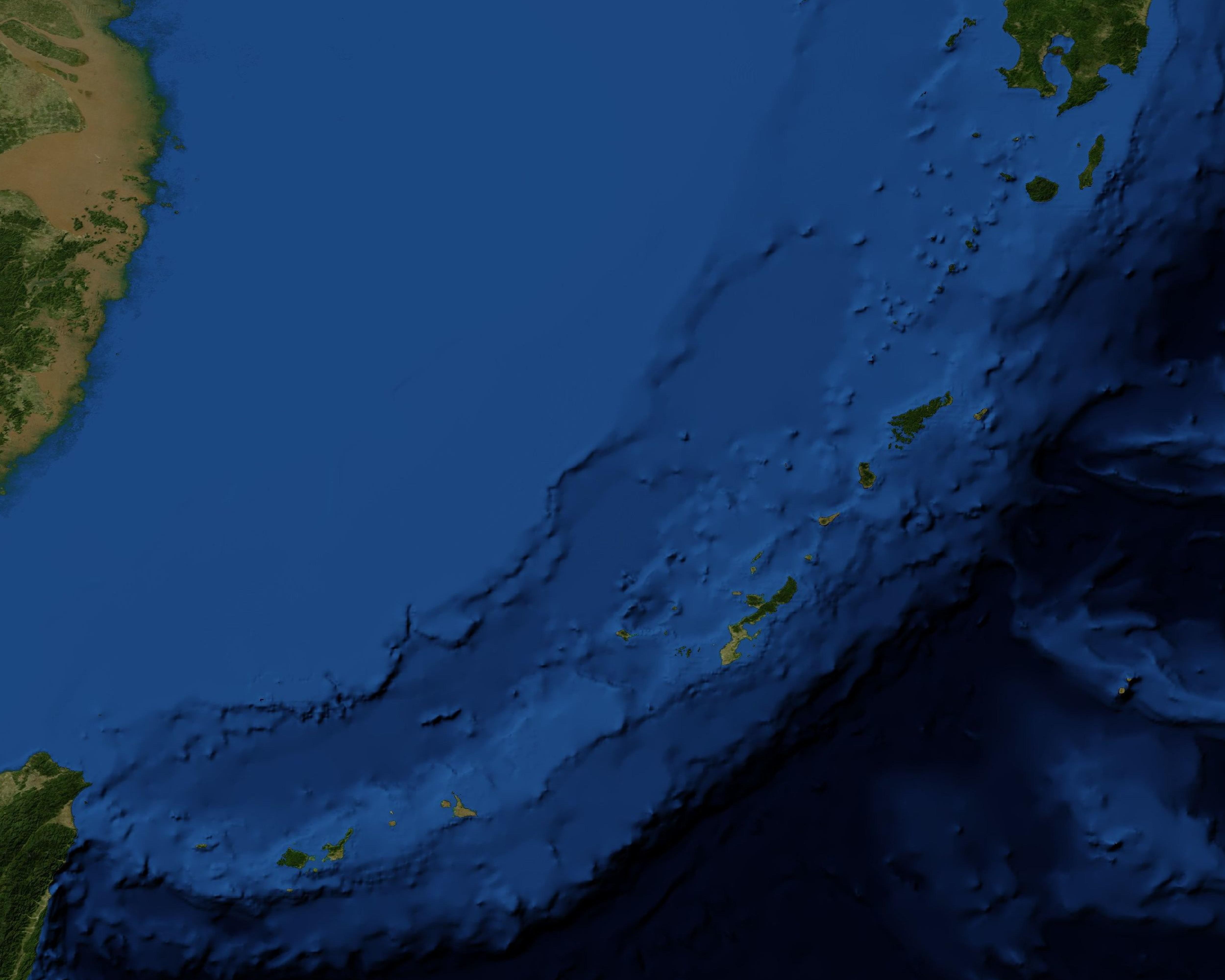
English: Nansei Island (Nansei Shotō ), Japan.
日本語: 南西諸島とその周辺の海底地形図 |
| Date | |
| Source | https://earthdata.nasa.gov/labs/worldview |
| Author | Blue Marble (August 2004, Shaded Relief and Bathymetry), MODIS / NASA Earth Observatory |
| Other versions |
|

Licensing
edit
| This file is in the public domain in the United States because it was solely created by NASA. NASA copyright policy states that "NASA material is not protected by copyright unless noted". (See Template:PD-USGov, NASA copyright policy page or JPL Image Use Policy.) | ||
 |
Warnings:
|
File history
Click on a date/time to view the file as it appeared at that time.
| Date/Time | Thumbnail | Dimensions | User | Comment | |
|---|---|---|---|---|---|
| current | 06:55, 1 February 2016 | | 5,000 × 4,000 (708 KB) | Kugel~commonswiki (talk | contribs) | == {{int:filedesc}} == {{Information |Description={{en|Nansei Island (''Nansei Shotō'' ), Japan.}} {{ja|南西諸島とその周辺の海底地形図}} |Source=https://earthdata.nasa.gov/labs/worldview |Date=2004-08 |Author=Blue Marble (August 2004, S... |
You cannot overwrite this file.
File usage on Commons
The following 2 pages use this file: