File:Narewka (gmina) location map.png

Size of this preview: 660 × 600 pixels. Other resolutions: 264 × 240 pixels | 528 × 480 pixels | 845 × 768 pixels | 1,081 × 982 pixels.
Original file (1,081 × 982 pixels, file size: 142 KB, MIME type: image/png)
Captions
Captions
Add a one-line explanation of what this file represents
| Description |
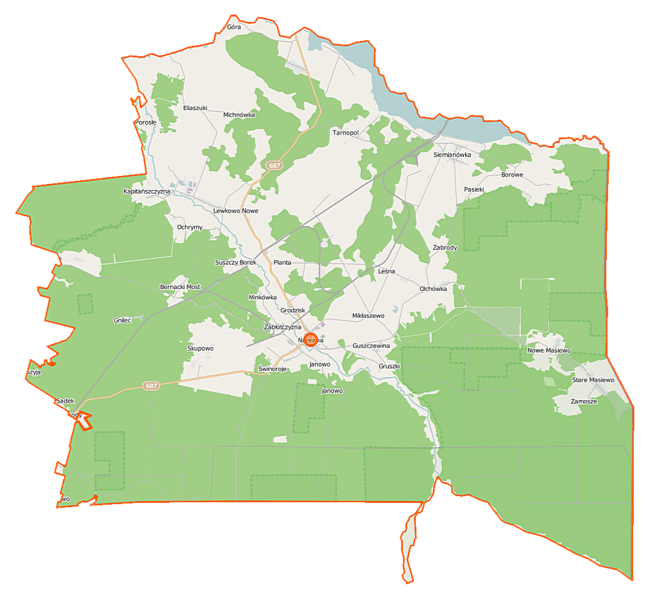
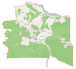
Polski: Mapa gminy Narewka, Polska
English: Map of Gmina Narewka, Poland |
|||||||||
| Date | ||||||||||
| Source | You may find a page on the OpenStreetMap wiki page for Narewka (gmina) | |||||||||
| Creator |
OpenStreetMap contributors OpenStreetMap contributors |
|||||||||
| Permission (Reusing this file) |
OpenStreetMap data is available under the Open Database License (details). Map tiles are licensed under the Creative Commons Attribution-ShareAlike 2.0 license (CC-BY-SA 2.0).
This file is licensed under the Creative Commons Attribution-Share Alike 2.0 Generic license.
|
|||||||||
| Geotemporal data | ||||||||||
| Bounding box |
|
|||||||||
| Georeferencing | If inappropriate please set warp_status = skip to hide. | |||||||||
File history
Click on a date/time to view the file as it appeared at that time.
| Date/Time | Thumbnail | Dimensions | User | Comment | |
|---|---|---|---|---|---|
| current | 20:02, 1 November 2014 | | 1,081 × 982 (142 KB) | VanWiel (talk | contribs) | |
| 09:45, 16 September 2014 |  | 1,081 × 982 (229 KB) | VanWiel (talk | contribs) | ||
| 05:48, 11 June 2014 |  | 1,081 × 982 (222 KB) | VanWiel (talk | contribs) | {{OpenStreetMap | name = Narewka (gmina) | location = Narewka (gmina) | description = {{pl|Mapa gminy Narewka, Polska}} {{en|Map of Gmina Narewka, Poland}} | top = 52.9511 | left = 23.5835 | right... |
You cannot overwrite this file.
File usage on Commons
There are no pages that use this file.
File usage on other wikis
The following other wikis use this file:
- Usage on be-tarask.wikipedia.org
- Usage on bg.wikipedia.org
- Usage on de.wikipedia.org
- Usage on fi.wikipedia.org
- Usage on pl.wikipedia.org
- Siemianówka (Polska)
- Nowa Łuka
- Narewka (gmina)
- Rezerwat przyrody Dolina Waliczówki
- Rezerwat przyrody Głuszec
- Rezerwat przyrody Gnilec
- Eliaszuki
- Guszczewina
- Michnówka
- Mikłaszewo
- Narewka
- Lewkowo Nowe
- Nowe Masiewo
- Ochrymy
- Podlewkowie
- Skupowo
- Lewkowo Stare
- Stare Masiewo
- Zabłotczyzna
- Tarnopol (Polska)
- Leśna (województwo podlaskie)
- Łuka (województwo podlaskie)
- Olchówka (województwo podlaskie)
- Pasieki (województwo podlaskie)
- Grodzisk (powiat hajnowski)
- Krynica (powiat hajnowski)
- Planta (powiat hajnowski)
- Stoczek (powiat hajnowski)
- Janowo (gmina Narewka)
- Rezerwat przyrody Siemianówka
- Rezerwat przyrody Wilczy Szlak
- Babia Góra (Pasieki)
- Suszczy Borek
- Kapitańszczyzna
- Siemieniakowszczyzna
- Bernacki Most
- Podochrymy
- Słobódka (Nowa Łuka)
- Chomińszczyzna
- Cieremki
- Dąbrowa (Michnówka)
- Zabrody (Olchówka)
- Połymie
- Świnoroje
- Zamosze (Stare Masiewo)
- Gnilec (osada)
View more global usage of this file.
_location_map.png)
_location_map.png&oldid=519984666)