File:Nate 2017-10-06 1400Z.jpg
Size of this preview: 800 × 597 pixels. Other resolutions: 320 × 239 pixels | 640 × 477 pixels | 1,024 × 764 pixels | 1,280 × 955 pixels | 1,500 × 1,119 pixels.
Original file (1,500 × 1,119 pixels, file size: 325 KB, MIME type: image/jpeg)
Captions
Captions
Add a one-line explanation of what this file represents
Summary
edit
| Description |
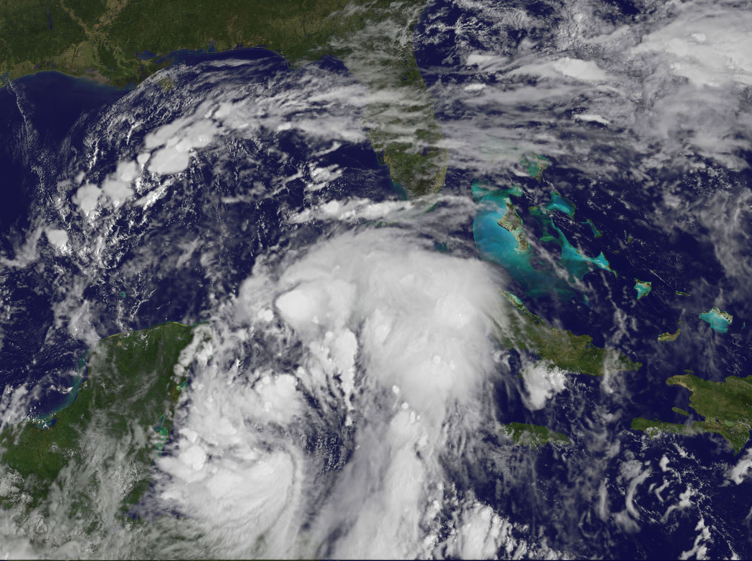
English: On Oct. 6 at 10 a.m. EDT (1400 UTC) NOAA’s GOES East satellite provided a visible image of Nate that showed the center back over water in the northwestern Caribbean Sea. Powerful thunderstorms circled the center and east of the center. |
| Date | |
| Source | https://www.nasa.gov/feature/goddard/2017/td16-southwestern-caribbean-ocean |
| Author | NOAA |
Licensing
edit
This image is in the public domain because it contains materials that originally came from the U.S. National Oceanic and Atmospheric Administration, taken or made as part of an employee's official duties.
|
File history
Click on a date/time to view the file as it appeared at that time.
| Date/Time | Thumbnail | Dimensions | User | Comment | |
|---|---|---|---|---|---|
| current | 06:31, 27 October 2017 | | 1,500 × 1,119 (325 KB) | A1Cafel (talk | contribs) | Original size |
| 02:06, 7 October 2017 |  | 985 × 735 (163 KB) | A1Cafel (talk | contribs) | User created page with UploadWizard |
You cannot overwrite this file.
File usage on Commons
There are no pages that use this file.