File:Nautical Chart Belle Isle Cook 1766 nla.obj-231254777.jpg

Size of this preview: 787 × 599 pixels. Other resolutions: 315 × 240 pixels | 630 × 480 pixels | 1,008 × 768 pixels | 1,280 × 975 pixels | 2,560 × 1,950 pixels | 9,410 × 7,168 pixels.
Original file (9,410 × 7,168 pixels, file size: 7.48 MB, MIME type: image/jpeg)
Captions
Captions
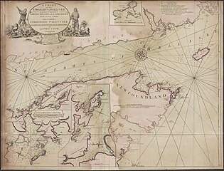
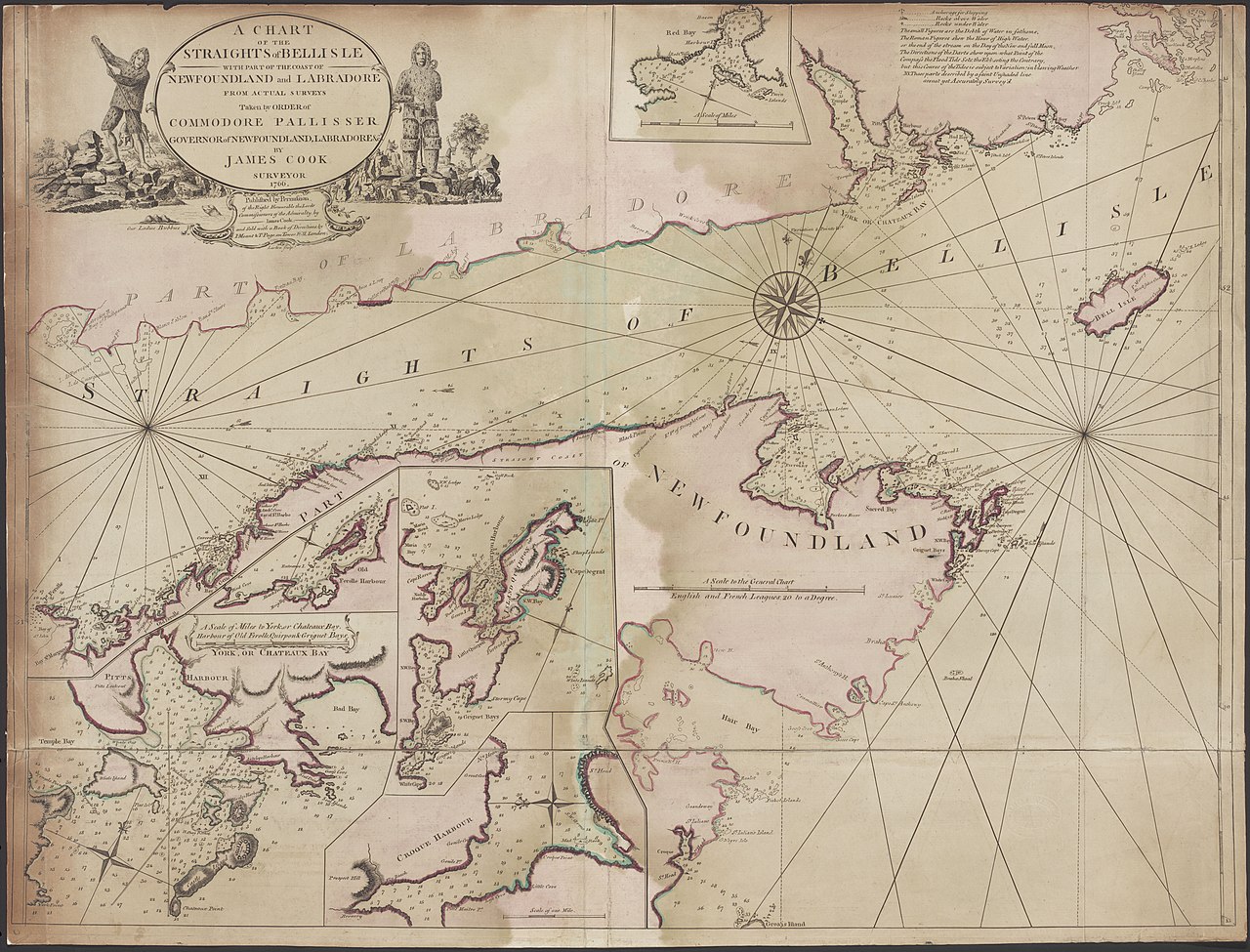
Nautical Chart of Belle Isle
Summary
edit
| Description |
English: A chart of the Straights of Bellisle : with part of the coast of Newfoundland and Labradore from actual surveys taken by order of Commodore Pallisser, Governor of Newfoundland, Labrador, &ca. / by James Cook, surveyor ; Larken, sculpt |
| Date | |
| Source | https://nla.gov.au/nla.obj-231254777/view |
| Author | James Cook (1728 – 1779) |
Licensing
edit
|
This work is in the public domain in its country of origin and other countries and areas where the copyright term is the author's life plus 70 years or fewer. This work is in the public domain in the United States because it was published (or registered with the U.S. Copyright Office) before January 1, 1929. | |
| This file has been identified as being free of known restrictions under copyright law, including all related and neighboring rights. | |
File history
Click on a date/time to view the file as it appeared at that time.
| Date/Time | Thumbnail | Dimensions | User | Comment | |
|---|---|---|---|---|---|
| current | 21:53, 31 October 2021 | | 9,410 × 7,168 (7.48 MB) | Kognos (talk | contribs) | Uploaded a work by James Cook (1728 – 1779) from https://nla.gov.au/nla.obj-231254777/view with UploadWizard |
You cannot overwrite this file.
File usage on Commons
The following 3 pages use this file: