File:Neckar-Ursprung Tafel.jpg
Size of this preview: 800 × 586 pixels. Other resolutions: 320 × 234 pixels | 640 × 469 pixels | 1,024 × 750 pixels | 1,280 × 937 pixels | 1,704 × 1,248 pixels.
Original file (1,704 × 1,248 pixels, file size: 616 KB, MIME type: image/jpeg)
Captions
Captions
Add a one-line explanation of what this file represents
| Description | |
| Date | |
| Source | Own work |
| Author | Ikar.us (talk) |
| Permission (Reusing this file) |
I, the copyright holder of this work, hereby publish it under the following license: This file is licensed under the Creative Commons Attribution 3.0 Germany license.
 |
| Other versions |
 |
| Camera location | | View this and other nearby images on: OpenStreetMap |
|---|
| Annotations | This image is annotated: View the annotations at Commons |
File history
Click on a date/time to view the file as it appeared at that time.
| Date/Time | Thumbnail | Dimensions | User | Comment | |
|---|---|---|---|---|---|
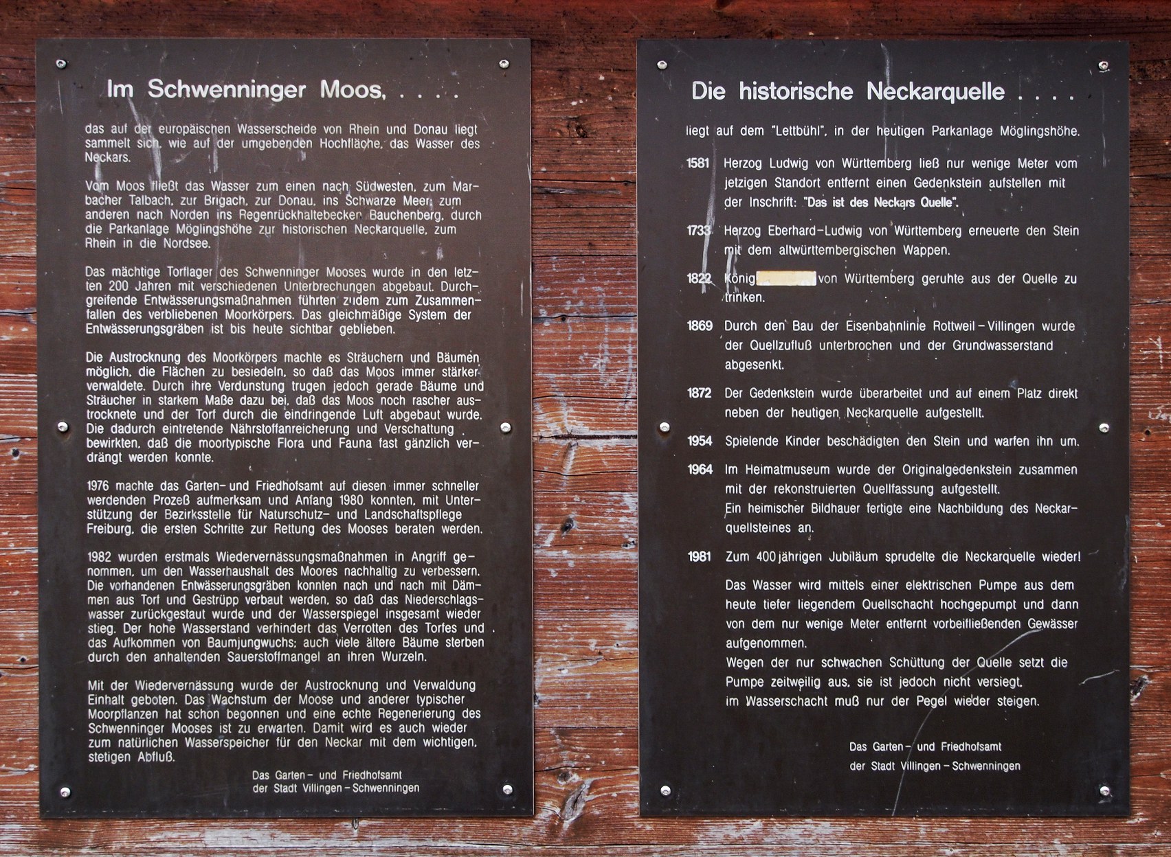
| current | 09:23, 6 July 2013 | | 1,704 × 1,248 (616 KB) | Ikar.us (talk | contribs) | {{Information |Description={{de|Informationstafeln am Necker-Ursprung im de:Schwenninger Moos}} |Source={{own}} |Date=2013-06-10 |Author=~~~ |Permission={{self|cc-by-3.0-de}} |other_versions=thumb|left|Standort }... |
You cannot overwrite this file.
File usage on Commons
The following 2 pages use this file:
File usage on other wikis
The following other wikis use this file:
- Usage on de.wikipedia.org