File:Nederland vestingstedenkaart2.png
No higher resolution available.
Nederland_vestingstedenkaart2.png (383 × 425 pixels, file size: 25 KB, MIME type: image/png)
Captions
Captions
Add a one-line explanation of what this file represents
Summary
edit
| Description |
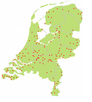
Behalve vestingsteden zijn ook de versterkte steden aangegeven. Oorspronkelijke kaart van Mtcv, zelf bewerkt, versie 2 |
| Date | 23 October 2004 (original upload date) |
| Source | Transferred from nl.wikipedia to Commons. |
| Author | Kliek at Dutch Wikipedia |
Licensing
edit
| This work has been released into the public domain by its author, Kliek at Dutch Wikipedia. This applies worldwide. In some countries this may not be legally possible; if so: Kliek grants anyone the right to use this work for any purpose, without any conditions, unless such conditions are required by law. |
Original upload log
edit
The original description page was here. All following user names refer to nl.wikipedia.
- 2004-10-23 14:23 Kliek 383×425×8 (25560 bytes) oorspr. kaart Mtcv, zelf bewerkt, versie 2
File history
Click on a date/time to view the file as it appeared at that time.
| Date/Time | Thumbnail | Dimensions | User | Comment | |
|---|---|---|---|---|---|
| current | 21:10, 10 April 2007 | | 383 × 425 (25 KB) | SieBot (talk | contribs) | {{Information |Description=Behalve vestingsteden zijn ook de ''versterkte'' steden aangegeven. <br> Oorspr. kaart Mtcv, zelf bewerkt, versie 2 |Source=Originally from [http://nl.wikipedia.org nl.wikipedia]; description page is/was [http://nl.wikipedia.or |
You cannot overwrite this file.
File usage on Commons
There are no pages that use this file.
File usage on other wikis
The following other wikis use this file:
- Usage on nds-nl.wikipedia.org
- Usage on nl.wikipedia.org