File:Nekonečné duny na pobřeží u Sandwich Harbour - panoramio.jpg

Size of this preview: 400 × 600 pixels. Other resolutions: 160 × 240 pixels | 320 × 480 pixels | 512 × 768 pixels | 682 × 1,024 pixels | 1,365 × 2,048 pixels | 3,840 × 5,760 pixels.
Original file (3,840 × 5,760 pixels, file size: 6.51 MB, MIME type: image/jpeg)
Captions
Captions
Add a one-line explanation of what this file represents
Summary
edit
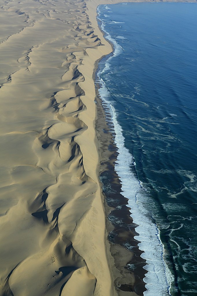
| Description | Nekonečné duny na pobřeží u Sandwich Harbour | ||
| Date | Taken on 12 August 2014 | ||
| Source | https://www.panoramio.com/photo/111123128 | ||
| Author | Martin Cígler | ||
| Permission (Reusing this file) |
This file is licensed under the Creative Commons Attribution-Share Alike 3.0 Unported license. Attribution: Martin Cígler
|
||
| Tags (from Panoramio photo page) | Namibia, Namibie |
| Camera location | | View this and other nearby images on: OpenStreetMap |
|---|
File history
Click on a date/time to view the file as it appeared at that time.
| Date/Time | Thumbnail | Dimensions | User | Comment | |
|---|---|---|---|---|---|
| current | 08:57, 14 April 2017 | | 3,840 × 5,760 (6.51 MB) | Panoramio upload bot (talk | contribs) | == {{int:filedesc}} == {{Information |description=Nekonečné duny na pobřeží u Sandwich Harbour |date={{Taken on|2014-08-12}} |source=http://www.panoramio.com/photo/111123128 |author=[http://www.panoramio.com/user/7863635?with_photo_id=111123128 Ma... |
You cannot overwrite this file.
File usage on Commons
There are no pages that use this file.