File:Nesserlanderhoeft.jpg
Nesserlanderhoeft.jpg (688 × 597 pixels, file size: 282 KB, MIME type: image/jpeg)
Captions
Captions
| Description |
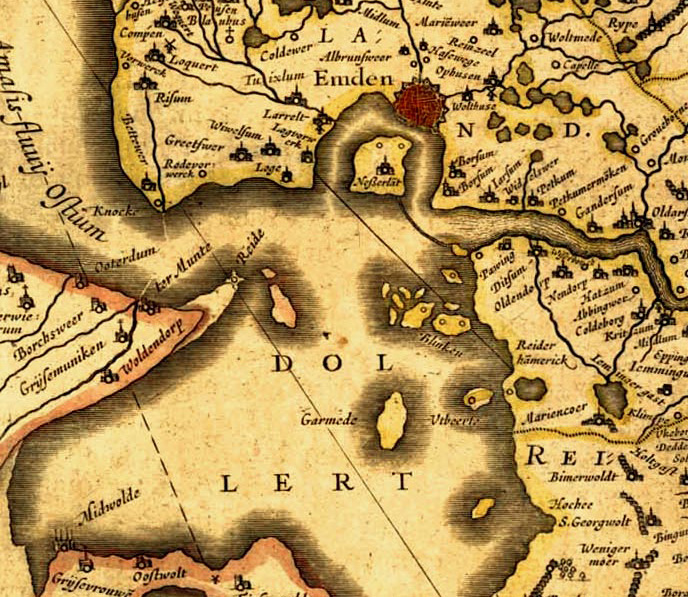
Deutsch: Alte Karte von Ostfriesland. English: Old map of East Frisia. Plattdüütsch: aulte landkoort vun Oostfreesland Español: mapa antigua de Frisia oriental |
| Date | etwa 1600 |
| Source |
 |
| Author |
|
|
This work is in the public domain in its country of origin and other countries and areas where the copyright term is the author's life plus 70 years or fewer.
| |
| This file has been identified as being free of known restrictions under copyright law, including all related and neighboring rights. | |
Original upload log
edit
This image is a derivative work of the following images:
- File:Frisiae-edited.jpg licensed with PD-old
- 2007-01-16T22:03:01Z Enricopedia 2878x2225 (1790693 Bytes) {{Information |Description= {{de|Alte Karte von [[:de:Ostfriesland|Ostfriesland]].}}{{en|Old map of [[en:East Frisia|East Frisia]].}} |Source= http://www.library.ucla.edu/yrl/reference/maps/blaeu/frisiae.jpg |Date=14th centur
Uploaded with derivativeFX
File history
Click on a date/time to view the file as it appeared at that time.
| Date/Time | Thumbnail | Dimensions | User | Comment | |
|---|---|---|---|---|---|
| current | 09:55, 15 January 2010 | | 688 × 597 (282 KB) | Matthias Süßen (talk | contribs) | {{Information |Description={{de|Alte Karte von Ostfriesland.}}{{en|Old map of East Frisia.}}{{nds|aulte landkoort vun Oostfreesland}}{{es|mapa antigua de [[:es:Frisia oriental|Frisia oriental |
You cannot overwrite this file.
File usage on Commons
There are no pages that use this file.
File usage on other wikis
The following other wikis use this file:
- Usage on de.wikipedia.org
- Usage on nl.wikipedia.org