File:Nevada ecoregion map.gif

Size of this preview: 416 × 599 pixels. Other resolutions: 167 × 240 pixels | 333 × 480 pixels | 533 × 768 pixels | 711 × 1,024 pixels | 1,434 × 2,065 pixels.
Original file (1,434 × 2,065 pixels, file size: 481 KB, MIME type: image/gif, 0.1 s)
Captions
Captions
Add a one-line explanation of what this file represents
Summary
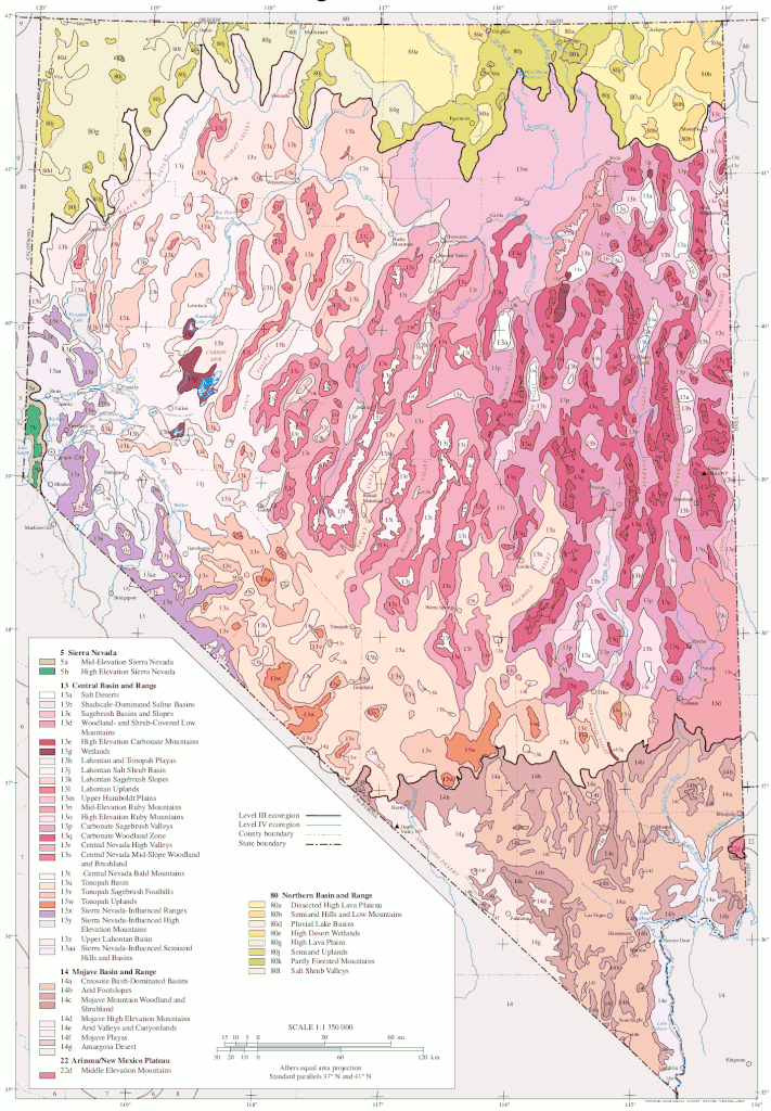
edit| Description | Map of EPA ecoregions of Nevada | |||||
| Date | 1 May 2022 (original upload date) | |||||
| Source | https://gaftp.epa.gov/EPADataCommons/ORD/Ecoregions/nv/nv_eco_pg.pdf | |||||
| Author | U.S. Environmental Protection Agency | |||||
| Permission (Reusing this file) |
|
|||||
| Other versions | ||||||
| Key |
|

File history
Click on a date/time to view the file as it appeared at that time.
| Date/Time | Thumbnail | Dimensions | User | Comment | |
|---|---|---|---|---|---|
| current | 06:46, 2 May 2022 | | 1,434 × 2,065 (481 KB) | Hike395 (talk | contribs) | remove minor artifacts |
| 03:12, 2 May 2022 |  | 1,434 × 2,065 (484 KB) | Hike395 (talk | contribs) | {{Information |Description=Map of EPA ecoregions of Nevada |Source=https://gaftp.epa.gov/EPADataCommons/ORD/Ecoregions/nv/nv_eco_pg.pdf |Date={{Original upload date|2022-05-01}} |Author=U.S. Environmental Protection Agency |Permission={{PD-USGov-EPA}} |other_versions={{Extracted|TonopahBasin.png|size=50}} }} |
You cannot overwrite this file.
File usage on Commons
There are no pages that use this file.
File usage on other wikis
The following other wikis use this file:
- Usage on en.wikipedia.org