File:New Hampshire Map (1895).jpg
Size of this preview: 394 × 600 pixels. Other resolutions: 158 × 240 pixels | 315 × 480 pixels | 504 × 768 pixels | 673 × 1,024 pixels | 1,692 × 2,575 pixels.
Original file (1,692 × 2,575 pixels, file size: 1.46 MB, MIME type: image/jpeg)
Captions
Captions
Add a one-line explanation of what this file represents
Summary edit
.jpg&action=edit§ion=1)
| Description |
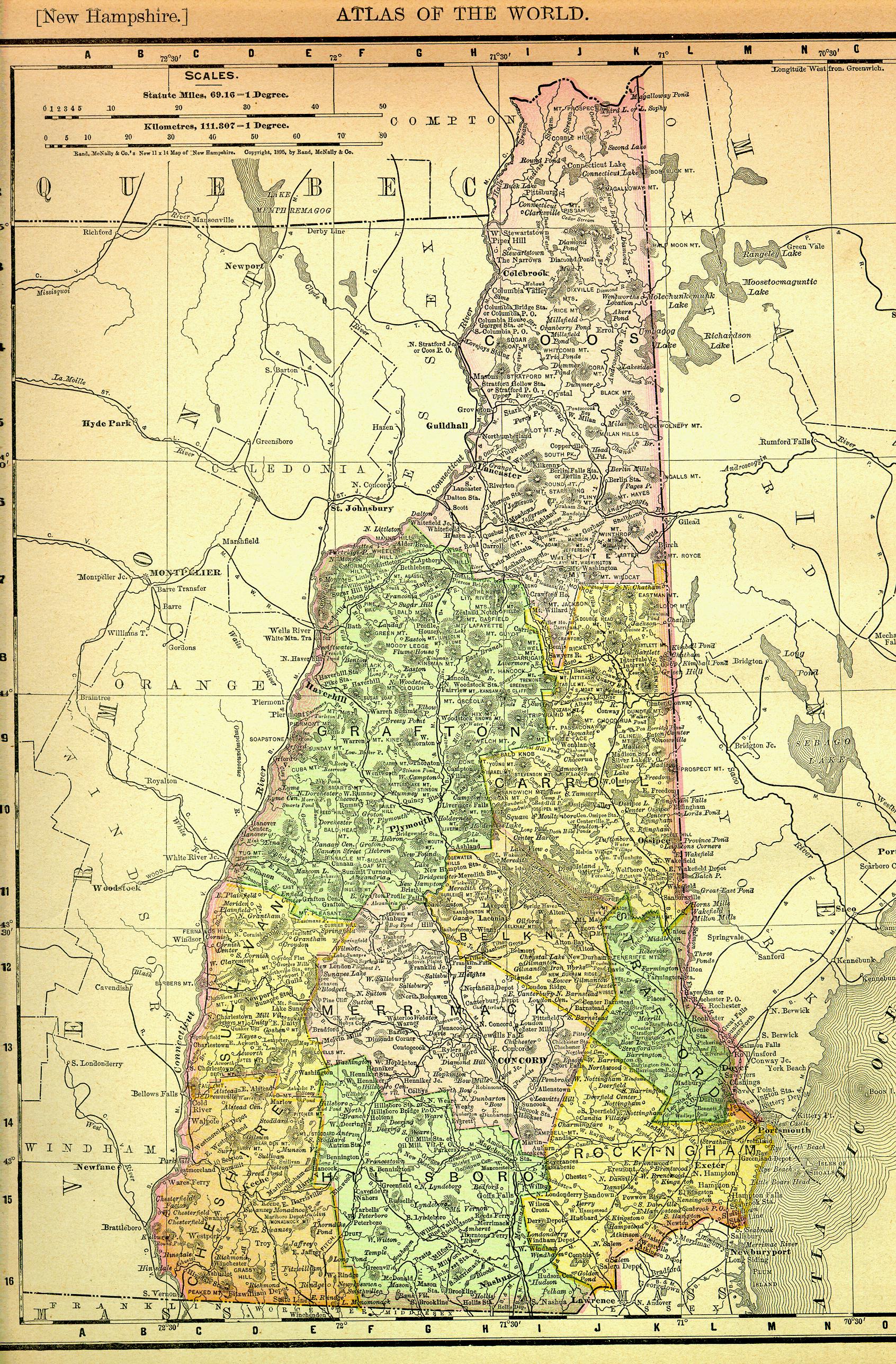
English: 1895 NH map Rand McNally Category:New Hampshire maps |
| Source | |
| Author |
Licensing edit
.jpg&action=edit§ion=2)
This media file is in the public domain in the United States. This applies to U.S. works where the copyright has expired, often because its first publication occurred prior to January 1, 1929, and if not then due to lack of notice or renewal. See this page for further explanation.
|
 | |
 |
This image might not be in the public domain outside of the United States; this especially applies in the countries and areas that do not apply the rule of the shorter term for US works, such as Canada, Mainland China (not Hong Kong or Macao), Germany, Mexico, and Switzerland. The creator and year of publication are essential information and must be provided. See Wikipedia:Public domain and Wikipedia:Copyrights for more details.
|
Original upload log edit
.jpg&action=edit§ion=3)
The original description page was here. All following user names refer to en.wikipedia.
- 2005-03-14 04:24 Lupinelawyer 1692×2575× (1530263 bytes) 1895 NH map Rand McNally [[Category:New Hampshier maps]]
File history
Click on a date/time to view the file as it appeared at that time.
| Date/Time | Thumbnail | Dimensions | User | Comment | |
|---|---|---|---|---|---|
| current | 04:34, 10 June 2011 | | 1,692 × 2,575 (1.46 MB) | File Upload Bot (Magnus Manske) (talk | contribs) | {{BotMoveToCommons|en.wikipedia|year={{subst:CURRENTYEAR}}|month={{subst:CURRENTMONTHNAME}}|day={{subst:CURRENTDAY}}}} {{Information |Description={{en|1895 NH map Rand McNally en:Category:New Hampshire maps}} |Source=Transferred from [http://en.wi |
You cannot overwrite this file.
File usage on Commons
There are no pages that use this file.
.jpg&oldid=673025984)