File:New South Wales South East1952 subdivision map.jpg

Size of this preview: 772 × 600 pixels. Other resolutions: 309 × 240 pixels | 618 × 480 pixels | 989 × 768 pixels | 1,280 × 995 pixels | 2,560 × 1,989 pixels | 17,313 × 13,453 pixels.
Original file (17,313 × 13,453 pixels, file size: 149.06 MB, MIME type: image/jpeg)
Captions
Captions
Add a one-line explanation of what this file represents
Summary
edit
| Warning | The original file is very high-resolution. It might not load properly or could cause your browser to freeze when opened at full size. |
|---|
| Description |
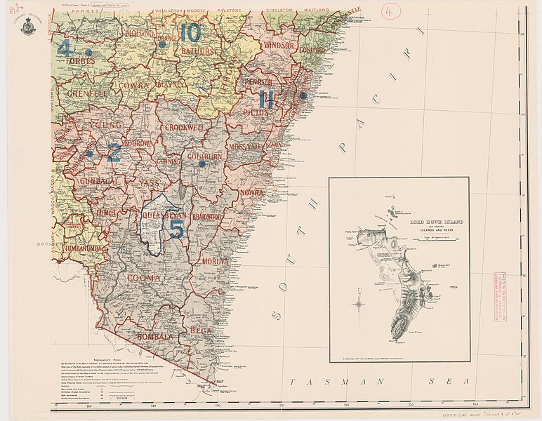
English: Map of New South Wales including Lord Howe Island, showing land districts and land board districts and administrative districts (Western Division) . Southeastern sheet of four map sheets, Original size of paper map sheet 57 x 73 cm |
| Date | |
| Source | http://nla.gov.au/nla.obj-466252912/view |
| Author | New South Wales. Department of Lands |
Licensing
edit
This image is protected by Crown Copyright because it is owned by the Australian Government or that of the states or territories, and is in the public domain because it was created or published prior to 1974 and the copyright has therefore expired. The government of Australia has declared that the expiration of Crown Copyrights applies worldwide. This has been confirmed by correspondence received by the Volunteer Response Team (Ticket:2017062010010417).
|
 |
File history
Click on a date/time to view the file as it appeared at that time.
| Date/Time | Thumbnail | Dimensions | User | Comment | |
|---|---|---|---|---|---|
| current | 21:27, 2 January 2019 | | 17,313 × 13,453 (149.06 MB) | Ratzer (talk | contribs) | User created page with UploadWizard |
You cannot overwrite this file.
File usage on Commons
There are no pages that use this file.