File:Newark Lock on the River Wey Navigation - geograph.org.uk - 96572.jpg
No higher resolution available.
Newark_Lock_on_the_River_Wey_Navigation_-_geograph.org.uk_-_96572.jpg (640 × 480 pixels, file size: 165 KB, MIME type: image/jpeg)
Captions
Captions
Add a one-line explanation of what this file represents
Summary
edit
| Description |
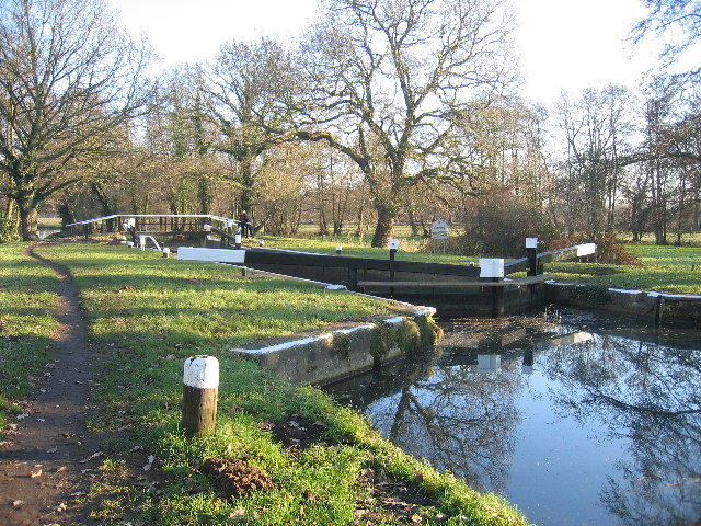
English: Newark Lock on the River Wey Navigation. The Wey Navigation opened in 1653 and was one of the first British rivers to be made navigable. In 1764 the Godalming Navigation opened, creating a 20-mile waterway running from the Thames at Weybridge to Godalming - now the southern-most part of the inland waterway network. Originally the Wey Navigations were used for transporting barge loads of heavy goods via the Thames to London. Timber, coal, corn, flour, wood and even gunpowder were regularly moved up and down the waterway. |
| Date | |
| Source | From geograph.org.uk |
| Author | Pip Rolls |
| Attribution (required by the license) | Pip Rolls / Newark Lock on the River Wey Navigation / |
| Object location | | View this and other nearby images on: OpenStreetMap |
|---|
_&language=en)
Licensing
edit

|
This image was taken from the Geograph project collection. See this photograph's page on the Geograph website for the photographer's contact details. The copyright on this image is owned by Pip Rolls and is licensed for reuse under the Creative Commons Attribution-ShareAlike 2.0 license.
|
This file is licensed under the Creative Commons Attribution-Share Alike 2.0 Generic license.
Attribution: Pip Rolls
- You are free:
- to share – to copy, distribute and transmit the work
- to remix – to adapt the work
- Under the following conditions:
- attribution – You must give appropriate credit, provide a link to the license, and indicate if changes were made. You may do so in any reasonable manner, but not in any way that suggests the licensor endorses you or your use.
- share alike – If you remix, transform, or build upon the material, you must distribute your contributions under the same or compatible license as the original.
File history
Click on a date/time to view the file as it appeared at that time.
| Date/Time | Thumbnail | Dimensions | User | Comment | |
|---|---|---|---|---|---|
| current | 23:47, 30 January 2010 | | 640 × 480 (165 KB) | GeographBot (talk | contribs) | == {{int:filedesc}} == {{Information |description={{en|1=Newark Lock on the River Wey Navigation. The Wey Navigation opened in 1653 and was one of the first British rivers to be made navigable. In 1764 the Godalming Navigation opened, creating a 20-mile w |
You cannot overwrite this file.
File usage on Commons
There are no pages that use this file.