File:Nh1d.PNG
Nh1d.PNG (754 × 515 pixels, file size: 99 KB, MIME type: image/png)
Captions
Captions
Summary
edit
| Description | |
| Date | |
| Source | Basic map is from OpenStreetMaps (Cycle Map layer); names and locations added by me taking reference from en:File:Kashmir map.svg |
| Author |
|
Licensing
edit
- You are free:
- to share – to copy, distribute and transmit the work
- to remix – to adapt the work
- Under the following conditions:
- attribution – You must give appropriate credit, provide a link to the license, and indicate if changes were made. You may do so in any reasonable manner, but not in any way that suggests the licensor endorses you or your use.
- share alike – If you remix, transform, or build upon the material, you must distribute your contributions under the same or compatible license as the original.
| Description |
This map was created from OpenStreetMap project data, collected by the community. This map may be incomplete, and may contain errors. Don't rely solely on it for navigation. |
|||
| Date | (see file history) | |||
| Source | openstreetmap.org | |||
| Creator |
OpenStreetMap contributors |
|||
| Permission (Reusing this file) |
OpenStreetMap data is available under the Open Database License (details). Map tiles are licensed under the Creative Commons Attribution-ShareAlike 2.0 license (CC-BY-SA 2.0).
This file is licensed under the Creative Commons Attribution-Share Alike 2.0 Generic license.
|
|||
| Georeferencing | If inappropriate please set warp_status = skip to hide. |
Original upload log
edit
Transferred from en.wikipedia to Commons by Ashok modhvadia.
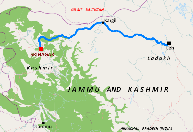
- 2011-03-21 07:57 Tatiraju.rishabh 754×515× (101876 bytes) {Information |Description= {{en|Map of [[National Highway 1D (India)]]}} |Source=Basic map is from OpenStreetMaps (Cycle Map layer); names and locations added by me taking reference from <nowiki>[[File:Kashmir map.svg]] |Date=2011-03-21 |Author= </nowiki>
File history
Click on a date/time to view the file as it appeared at that time.
| Date/Time | Thumbnail | Dimensions | User | Comment | |
|---|---|---|---|---|---|
| current | 09:50, 28 November 2013 | | 754 × 515 (99 KB) | Ashok modhvadia (talk | contribs) | {{Information |Description={{en|en:Category:OpenStreetMap maps}} |Source=Transferred from [http://en.wikipedia.org en.wikipedia]; transfer was stated to be made by User:Ashok modhvadia.<br/> (Original text : ''Basic map is from OpenStreetMaps... |
You cannot overwrite this file.
File usage on Commons
The following page uses this file:
File usage on other wikis
The following other wikis use this file:
- Usage on bn.wikipedia.org
- Usage on de.wikipedia.org
- Usage on en.wikipedia.org
- Usage on gu.wikipedia.org
- Usage on ml.wikipedia.org
- Usage on ta.wikipedia.org
- Usage on www.wikidata.org