File:Nidda Mühle pano 3268.jpg

Original file (2,406 × 733 pixels, file size: 941 KB, MIME type: image/jpeg)
Captions
Captions
| Description | |||||||||||||||||||||||
| Date | |||||||||||||||||||||||
| Source | Self-photographed | ||||||||||||||||||||||
| Author | Sven Teschke, Büdingen | ||||||||||||||||||||||
| Permission (Reusing this file) |
This file is licensed under the Creative Commons Attribution-Share Alike 3.0 Germany license.

|
||||||||||||||||||||||
| Attribution (required by the license) |
|
||||||||||||||||||||||
| Camera location | | View this and other nearby images on: OpenStreetMap |
|---|
File history
Click on a date/time to view the file as it appeared at that time.
| Date/Time | Thumbnail | Dimensions | User | Comment | |
|---|---|---|---|---|---|
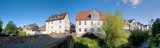
| current | 09:26, 24 May 2010 | 2,406 × 733 (941 KB) | Steschke (talk | contribs) | {{Information |Description={{de|Blick auf die Niddaer Altstadt mit Mühle und Mühlrad. Wetteraukreis, Hessen }} |Source= {{de|selbst fotografiert}} {{en|own work}} |Date=2010-05-23 |Author=[[:de:Benutzer |
You cannot overwrite this file.
File usage on Commons
The following 3 pages use this file:
File usage on other wikis
The following other wikis use this file:
- Usage on ar.wikipedia.org
- Usage on arz.wikipedia.org
- Usage on azb.wikipedia.org
- Usage on be.wikipedia.org
- Usage on bg.wikipedia.org
- Usage on ceb.wikipedia.org
- Usage on ce.wikipedia.org
- Usage on de.wikipedia.org
- Usage on en.wikipedia.org
- Usage on es.wikipedia.org
- Usage on eu.wikipedia.org
- Usage on fa.wikipedia.org
- Usage on hu.wikipedia.org
- Usage on it.wikipedia.org
- Usage on ku.wikipedia.org
- Usage on lld.wikipedia.org
- Usage on ms.wikipedia.org
- Usage on no.wikipedia.org
- Usage on pl.wikipedia.org
- Usage on pms.wikipedia.org
- Usage on pt.wikipedia.org
- Usage on ru.wikipedia.org
- Usage on simple.wikipedia.org
- Usage on sr.wikipedia.org
- Usage on sw.wikipedia.org
- Usage on tt.wikipedia.org
- Usage on uz.wikipedia.org
- Usage on www.wikidata.org