File:Nidder Karte.png

Size of this preview: 604 × 599 pixels. Other resolutions: 242 × 240 pixels | 484 × 480 pixels | 740 × 734 pixels.
Original file (740 × 734 pixels, file size: 167 KB, MIME type: image/png)
Captions
Captions
Add a one-line explanation of what this file represents
Summary edit
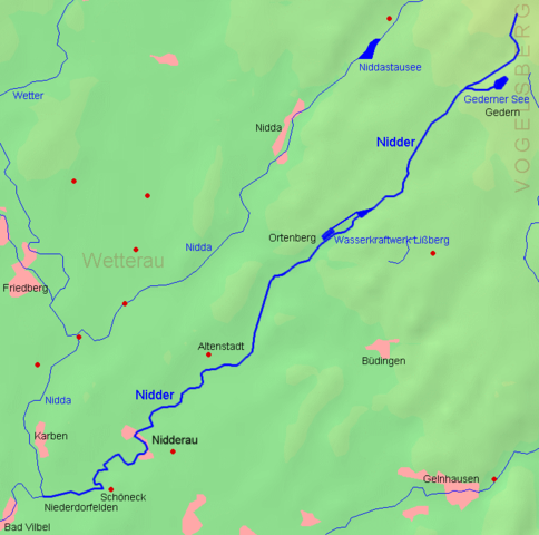
| Description |
Deutsch: Karte der Nidder
English: Map of the Nidder |
| Date | 12.09.2006 |
| Source | demis.nl PD-Karte, selbst bearbeitet / PD-map, edited by myself |
| Author |
MdE |
Licensing edit
This file is licensed under the Creative Commons Attribution-Share Alike 3.0 Unported license.
|

File history
Click on a date/time to view the file as it appeared at that time.
| Date/Time | Thumbnail | Dimensions | User | Comment | |
|---|---|---|---|---|---|
| current | 16:58, 12 September 2006 | | 740 × 734 (167 KB) | MdE (talk | contribs) | {{User:MdE*C/FotoCC |InfoDE=Karte der Nidder |InfoEN=Map of the ''Nidder'' |Datum=12.09.2006 |Quelle=[http://www.demis.nl/ demis.nl] PD-Karte, selbst bearbeitet / PD-map, edited by myself |Kategorie=Maps of Hesse }} [[Category:Wetteraukreis |
You cannot overwrite this file.
File usage on Commons
The following page uses this file:
File usage on other wikis
The following other wikis use this file:
- Usage on arz.wikipedia.org
- Usage on ceb.wikipedia.org
- Usage on cv.wikipedia.org
- Usage on da.wikipedia.org
- Usage on de.wikipedia.org
- Usage on fr.wikipedia.org
- Usage on www.wikidata.org