File:Nieder-Florstadt, Hessen-Darmstädter Rundsockelstundenstein.jpg

Size of this preview: 800 × 600 pixels. Other resolutions: 320 × 240 pixels | 640 × 480 pixels | 1,024 × 768 pixels | 1,280 × 960 pixels | 2,048 × 1,536 pixels.
Original file (2,048 × 1,536 pixels, file size: 363 KB, MIME type: image/jpeg)
Captions
Captions
Add a one-line explanation of what this file represents
Summary
edit
| Description |
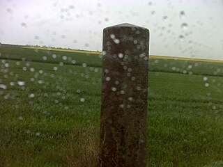
Deutsch: Westl. von Nieder-Florstadt an der B 275, Hessen-Darmstädter Rundsockelstundenstein
This is a photograph of an architectural monument. It is on the list of cultural monuments of Florstadt OT Nieder-Florstadt, no. 5253. |
||
| Date | Taken on 27 April 2019, 16:01 | ||
| Source | Self-photographed | ||
| Author | Manfred Schröter, Berga |
| Camera location | | View this and other nearby images on: OpenStreetMap |
|---|
Licensing
edit
Manfred Schröter, Berga, the copyright holder of this work, hereby publishes it under the following license:
This file is licensed under the Creative Commons Attribution-Share Alike 4.0 International license.
Attribution: Manfred Schröter, Berga
- You are free:
- to share – to copy, distribute and transmit the work
- to remix – to adapt the work
- Under the following conditions:
- attribution – You must give appropriate credit, provide a link to the license, and indicate if changes were made. You may do so in any reasonable manner, but not in any way that suggests the licensor endorses you or your use.
- share alike – If you remix, transform, or build upon the material, you must distribute your contributions under the same or compatible license as the original.

|
This image was uploaded as part of Wiki Loves Monuments 2019.
|
File history
Click on a date/time to view the file as it appeared at that time.
| Date/Time | Thumbnail | Dimensions | User | Comment | |
|---|---|---|---|---|---|
| current | 12:52, 9 September 2019 | | 2,048 × 1,536 (363 KB) | Manfred Schröter, Berga (talk | contribs) | == {{int:filedesc}} == {{Information |Description={{de|1=Westl. von Nieder-Florstadt an der B 275, Hessen-Darmstädter Rundsockelstundenstein}}{{Kulturdenkmal Hessen|5253}}{{Kulturdenkmal|Ort=Florstadt OT Nieder-Florstadt|Nummer=5253}} |Source={{own photo}} |Date={{taken on|location=Germany|2019-04-27 16:01}} |Author={{U|Manfred Schröter, Berga}} |Permission= |other_versions= }} == {{int:license-header}} == {{self|cc-by-sa-4.0|au... |
You cannot overwrite this file.
File usage on Commons
There are no pages that use this file.