File:Niederwiesa, Postamt mit Postkutschenszene (1).jpg

Size of this preview: 450 × 600 pixels. Other resolutions: 180 × 240 pixels | 360 × 480 pixels | 576 × 768 pixels | 768 × 1,024 pixels | 1,536 × 2,048 pixels.
Original file (1,536 × 2,048 pixels, file size: 372 KB, MIME type: image/jpeg)
Captions
Captions
Add a one-line explanation of what this file represents
Summary
edit.jpg&action=edit§ion=1)
| Description |
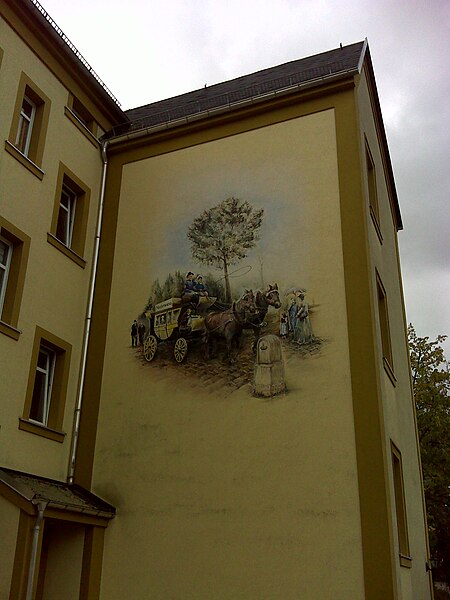
Deutsch: Niederwiesa, hintere Seite des ehemaligen Postamtes mit einem Wandgemälde, welches die Postkutschenzeit illustriert. Zu sehen ist auch der königlich-sächsische Halbmeilenstein des Ortes.
This is a photograph of a cultural monument. It is on the list of cultural monuments of Niederwiesa, no. 09240007. |
||
| Date | Taken on 15 October 2023, 11:15 | ||
| Source | Self-photographed | ||
| Author | Manfred Schröter, Berga |
| Camera location | | View this and other nearby images on: OpenStreetMap |
|---|
.jpg¶ms=050.863327_N_0013.022108_E_globe:Earth_type:camera_alt:307.318_source:exif_heading:294.53&language=en)
Licensing
edit.jpg&action=edit§ion=2)
Manfred Schröter, Berga, the copyright holder of this work, hereby publishes it under the following license:
This file is licensed under the Creative Commons Attribution-Share Alike 4.0 International license.
Attribution: Manfred Schröter, Berga
- You are free:
- to share – to copy, distribute and transmit the work
- to remix – to adapt the work
- Under the following conditions:
- attribution – You must give appropriate credit, provide a link to the license, and indicate if changes were made. You may do so in any reasonable manner, but not in any way that suggests the licensor endorses you or your use.
- share alike – If you remix, transform, or build upon the material, you must distribute your contributions under the same or compatible license as the original.
|
The photographical reproduction of this work is covered under the article § 59 of the German copyright law, which states that "It shall be permissible to reproduce, by painting, drawing, photography or cinematography, works which are permanently located on public ways, streets or places and to distribute and publicly communicate such copies. For works of architecture, this provision shall be applicable only to the external appearance."
As with all other “limits of copyright by legally permitted uses”, no changes to the actual work are permitted under § 62 of the German copyright law (UrhG). See Commons:Copyright rules by territory/Germany#Freedom of panorama for more information.
|
File history
Click on a date/time to view the file as it appeared at that time.
| Date/Time | Thumbnail | Dimensions | User | Comment | |
|---|---|---|---|---|---|
| current | 16:43, 31 October 2023 | | 1,536 × 2,048 (372 KB) | Manfred Schröter, Berga (talk | contribs) | == {{int:filedesc}} == {{Information |description={{de|1=Niederwiesa, hintere Seite des ehemaligen Postamtes mit einem Wandgemälde, welches die de:Postkutschenzeit illustriert. Zu sehen ist auch der königlich-sächsische Halbmeilenstein des Ortes}} {{Kulturdenkmal Sachsen |1=09240007}}{{Kulturdenkmal |Typ=Kulturdenkmal |Ort=Niederwiesa |Nummer=09... |
You cannot overwrite this file.
File usage on Commons
The following page uses this file:
.jpg&oldid=842572625)