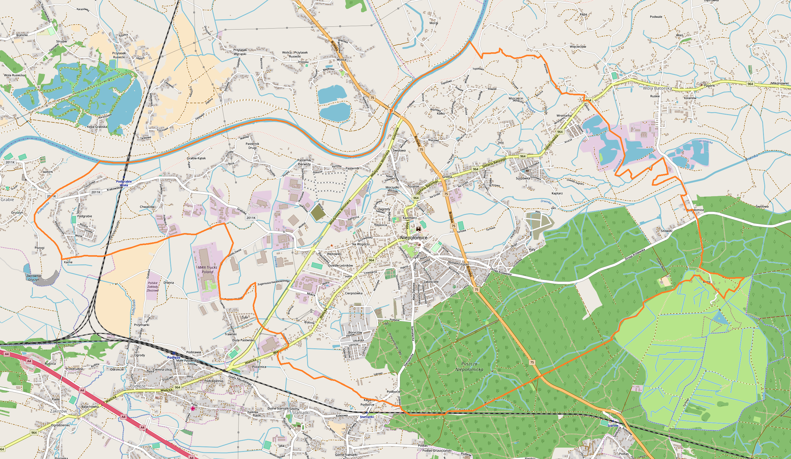
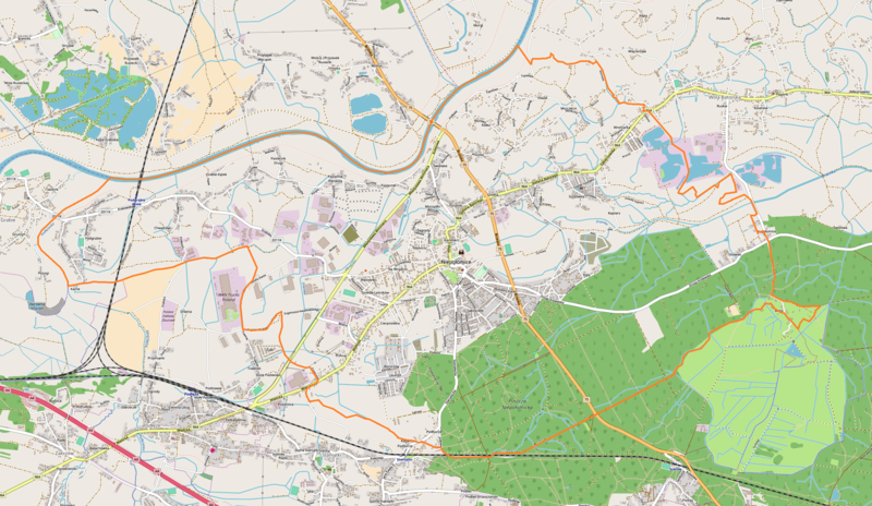
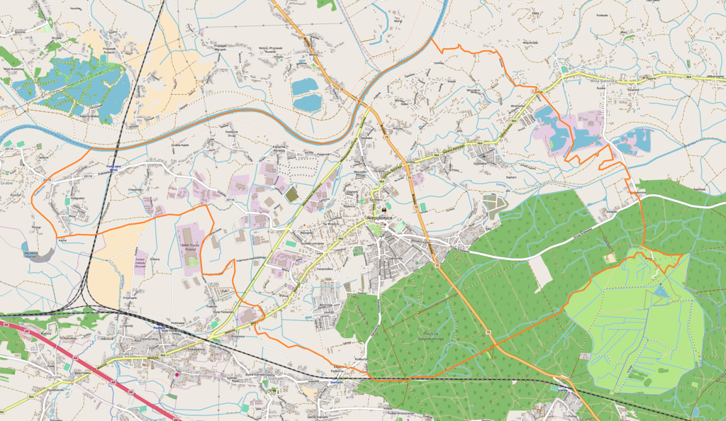
File:Niepołomice location map.png
Original file (2,573 × 1,493 pixels, file size: 3.1 MB, MIME type: image/png)
Captions
Captions
Summary
edit
| Description |
English: Location map |
| Date | |
| Source | Own work |
| Author | Smat |
| Description |
Polski: Mapa Niepołomic, Polska
English: Map of Niepołomice, Poland |
|||||||||
| Date | ||||||||||
| Source | You may find a page on the OpenStreetMap wiki page for Niepołomice | |||||||||
| Creator |
OpenStreetMap contributors OpenStreetMap contributors |
|||||||||
| Permission (Reusing this file) |
OpenStreetMap data is available under the Open Database License (details). Map tiles are licensed under the Creative Commons Attribution-ShareAlike 2.0 license (CC-BY-SA 2.0).
This file is licensed under the Creative Commons Attribution-Share Alike 2.0 Generic license.
|
|||||||||
| Geotemporal data | ||||||||||
| Bounding box |
|
|||||||||
| Georeferencing | If inappropriate please set warp_status = skip to hide. | |||||||||
Licensing
edit
| This work contains information from OpenStreetMap, which is made available under the Open Database License (ODbL).
The ODbL does not require any particular license for maps produced from ODbL data. Prior to 1 August 2020, map tiles produced by the OpenStreetMap Foundation were licensed under the CC-BY-SA-2.0 license. Maps produced by other people may be subject to other licences. |
File history
Click on a date/time to view the file as it appeared at that time.
| Date/Time | Thumbnail | Dimensions | User | Comment | |
|---|---|---|---|---|---|
| current | 10:10, 11 June 2018 | | 2,573 × 1,493 (3.1 MB) | Smat (talk | contribs) | User created page with UploadWizard |
You cannot overwrite this file.
File usage on Commons
There are no pages that use this file.
File usage on other wikis
The following other wikis use this file:
- Usage on pl.wikipedia.org
- Synagoga w Niepołomicach
- Zamek Królewski w Niepołomicach
- Ratusz w Niepołomicach
- Cmentarz żydowski w Niepołomicach
- Parafia Dziesięciu Tysięcy Męczenników w Niepołomicach
- Parafia Matki Boskiej Różańcowej w Niepołomicach-Jazach
- Niepołomice (stacja kolejowa)
- Niepołomice Pasternik
- Cmentarz wojenny nr 327 – Niepołomice
- Chwalców
- Poręby (Niepołomice)
- Boryczów
- Kościół Dziesięciu Tysięcy Męczenników w Niepołomicach
- Młodzieżowe Obserwatorium Astronomiczne w Niepołomicach
- Cmentarz wojenny nr 326 – Niepołomice
- Cmentarz wojenny nr 328 – Niepołomice
- Podgrabie Wisła
- Kopiec Grunwaldzki w Niepołomicach
- Rynek w Niepołomicach
- Ulica Grunwaldzka w Niepołomicach
- Cmentarz wojenny nr 329 – Podborze
- Osiedle Boryczów
- Osiedle Jazy
- Osiedle Podgrabie
- Grabie-Kątek
- Pasternik Drugi
- Karne
- Podgrabie (Niepołomice)
- Pasternik Pierwszy
- Pasternik (Niepołomice)
- Świdowa (Niepołomice)
- Kółko (Niepołomice)
- Mszczęcin
- Wroniarka
- Grobla (Niepołomice)
- Suszówka
- Jazy (Niepołomice)
- Kępina (Niepołomice)
- Poczyn
- Kaptarz
- Olszyna-Dębnik
- Sitowiec (Niepołomice)
- Błoto (Niepołomice)
- Kąty (Niepołomice)
- Ulica Adama Mickiewicza w Niepołomicach
- Ulica Szeroka w Niepołomicach
- Plac Zwycięstwa w Niepołomicach
- Ulica Parkowa w Niepołomicach
- Ulica Zamkowa w Niepołomicach
- Ulica 3 Maja w Niepołomicach
View more global usage of this file.