File:Niger, Route N4 near Sarando Béné.jpg
Size of this preview: 800 × 450 pixels. Other resolutions: 320 × 180 pixels | 640 × 360 pixels | 1,024 × 576 pixels | 1,280 × 720 pixels | 2,560 × 1,440 pixels | 4,000 × 2,250 pixels.
Original file (4,000 × 2,250 pixels, file size: 3.46 MB, MIME type: image/jpeg)
Captions
Captions
Add a one-line explanation of what this file represents
Summary edit
| Description |
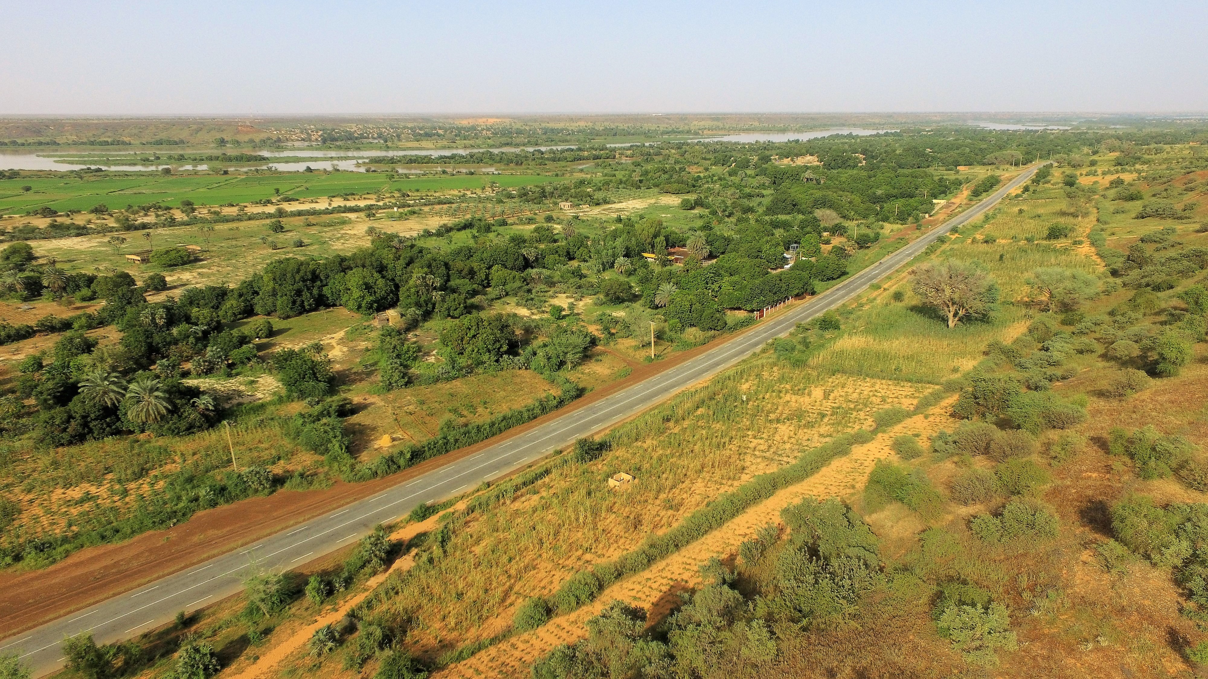
English: The National Road No.4 in Niger runs from Niamey to Tera and is seen here 1 km west of the village of Sarando Béné, looking toward Niamey. In the distance is the river Niger and on its other side the village of Boubon (left, far away).
Français : La route nationale n° 4 au Niger va de Niamey à Tera et est vue ici à 1 km à l'ouest du village de Sarando Béné. Au loin se trouve le fleuve Niger et de l'autre côté le village de Boubon (à gauche, loin). |
| Date | |
| Source | Own work |
| Author | NigerTZai |
Looking to the East-North-east from here:
| Camera location | | View this and other nearby images on: OpenStreetMap |
|---|
Licensing edit
I, the copyright holder of this work, hereby publish it under the following licenses:
This file is licensed under the Creative Commons Attribution-Share Alike 4.0 International license.
- You are free:
- to share – to copy, distribute and transmit the work
- to remix – to adapt the work
- Under the following conditions:
- attribution – You must give appropriate credit, provide a link to the license, and indicate if changes were made. You may do so in any reasonable manner, but not in any way that suggests the licensor endorses you or your use.
- share alike – If you remix, transform, or build upon the material, you must distribute your contributions under the same or compatible license as the original.

|
Permission is granted to copy, distribute and/or modify this document under the terms of the GNU Free Documentation License, Version 1.2 or any later version published by the Free Software Foundation; with no Invariant Sections, no Front-Cover Texts, and no Back-Cover Texts. A copy of the license is included in the section entitled GNU Free Documentation License. |
You may select the license of your choice.
File history
Click on a date/time to view the file as it appeared at that time.
| Date/Time | Thumbnail | Dimensions | User | Comment | |
|---|---|---|---|---|---|
| current | 19:30, 22 April 2020 | | 4,000 × 2,250 (3.46 MB) | NigerTZai (talk | contribs) | {{Information |description ={{en|1=The National Road No.4 in Niger runs from Niamey to Tera and is seen here 1 km west of the village of Sarando Béné, looking toward Niamey. In the distance is the river Niger and on its other side the village of Boubon (left, far away).}} {{fr|1= La route nationale n° 4 au Niger va de Niamey à Tera et est vue ici à 1 km à l'ouest du village de Sarando Béné. Au loin se trouve le fleuve Niger et de l'autre côté le village de Boubon (à gauche, loin).}} |date... |
You cannot overwrite this file.
File usage on Commons
The following 2 pages use this file:
File usage on other wikis
The following other wikis use this file:
- Usage on ceb.wikipedia.org
- Usage on de.wikipedia.org
- Usage on en.wikipedia.org
- Usage on es.wikipedia.org
- Usage on fr.wikipedia.org
- Usage on ha.wikipedia.org
- Usage on ro.wikipedia.org
- Usage on www.wikidata.org
- Usage on yo.wikipedia.org
- Usage on zu.wikipedia.org