File:Niger pop 1969.jpg

Size of this preview: 777 × 600 pixels. Other resolutions: 311 × 240 pixels | 622 × 480 pixels | 995 × 768 pixels | 1,254 × 968 pixels.
Original file (1,254 × 968 pixels, file size: 138 KB, MIME type: image/jpeg)
Captions
Captions
Add a one-line explanation of what this file represents
Summary
edit
| Description |
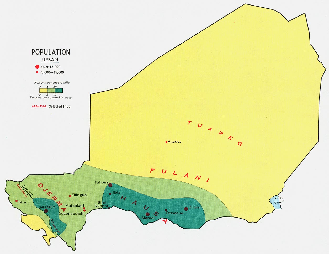
English: Population density map of Niger (1969) |
| Date | |
| Source |
University of Texas Libraries, Perry-Castañeda Library Map Collection: Niger Maps |
| Author | United States Central Intelligence Agency |
Licensing
edit
This image is in the public domain because it contains materials that originally came from the United States Central Intelligence Agency's World Factbook.
|
 |
File history
Click on a date/time to view the file as it appeared at that time.
| Date/Time | Thumbnail | Dimensions | User | Comment | |
|---|---|---|---|---|---|
| current | 01:30, 19 January 2009 | | 1,254 × 968 (138 KB) | T L Miles (talk | contribs) | {{Information |Description={{en|1=Population density map of Niger (1969)}} |Source=http://www.lib.utexas.edu/maps/africa/niger_pop_1969.jpg |Author=United States Central Intelligence Agency |Date=1969 |Permission= |other_versions= }} <!--{{ImageUpload|fu |
You cannot overwrite this file.
File usage on Commons
There are no pages that use this file.
File usage on other wikis
The following other wikis use this file:
- Usage on ar.wikipedia.org
- Usage on bg.wikipedia.org
- Usage on fr.wikipedia.org
- Usage on hu.wikipedia.org