File:Noirétable-6498.jpg

Size of this preview: 800 × 533 pixels. Other resolutions: 320 × 213 pixels | 640 × 427 pixels | 1,024 × 683 pixels | 1,280 × 853 pixels | 2,560 × 1,707 pixels | 4,962 × 3,308 pixels.
Original file (4,962 × 3,308 pixels, file size: 6.54 MB, MIME type: image/jpeg)
Captions
Captions
Add a one-line explanation of what this file represents
Summary edit
| Description |
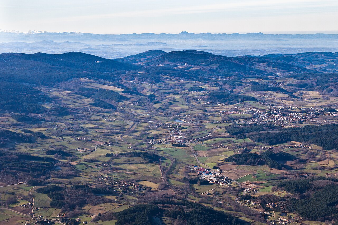
Français : Noirétable (Loire, Rhône-Alpes, France), vue générale vers l'ouest. Au premier plan, légèrement à droite du centre : hameau de la Pra (avec les containers bleus) sur la D1089, avec les hameaux de Chanet puis de la Valette Haute vers le bord inférieur de la photo ; l'Anzon, repérable par les arbres poussant le long de ses rives, coule sur leur gauche ; hameau de Noaillat légèrement à gauche du centre. Au centre, plan d'eau du camping municipal. Mi-plan : les monts du Forez. A l'horizon : Puy de Dôme au centre (78 km de Noirétable), Puy de Sancy sur la gauche (120 km de Noirétable). |
| Date | |
| Source | Own work |
| Author | Cbalg |
Licensing edit
I, the copyright holder of this work, hereby publish it under the following license:
This file is licensed under the Creative Commons Attribution-Share Alike 3.0 Unported license.
- You are free:
- to share – to copy, distribute and transmit the work
- to remix – to adapt the work
- Under the following conditions:
- attribution – You must give appropriate credit, provide a link to the license, and indicate if changes were made. You may do so in any reasonable manner, but not in any way that suggests the licensor endorses you or your use.
- share alike – If you remix, transform, or build upon the material, you must distribute your contributions under the same or compatible license as the original.
File history
Click on a date/time to view the file as it appeared at that time.
| Date/Time | Thumbnail | Dimensions | User | Comment | |
|---|---|---|---|---|---|
| current | 14:59, 29 November 2012 | | 4,962 × 3,308 (6.54 MB) | Cbalg (talk | contribs) | User created page with UploadWizard |
You cannot overwrite this file.
File usage on Commons
There are no pages that use this file.
File usage on other wikis
The following other wikis use this file:
- Usage on fr.wikipedia.org