File:Nordfriesland Karte 1823.jpg

Size of this preview: 706 × 599 pixels. Other resolutions: 283 × 240 pixels | 566 × 480 pixels | 905 × 768 pixels | 1,207 × 1,024 pixels | 2,413 × 2,048 pixels | 6,152 × 5,221 pixels.
Original file (6,152 × 5,221 pixels, file size: 3.5 MB, MIME type: image/jpeg)
Captions
Captions
Add a one-line explanation of what this file represents
Summary
edit
| Description |
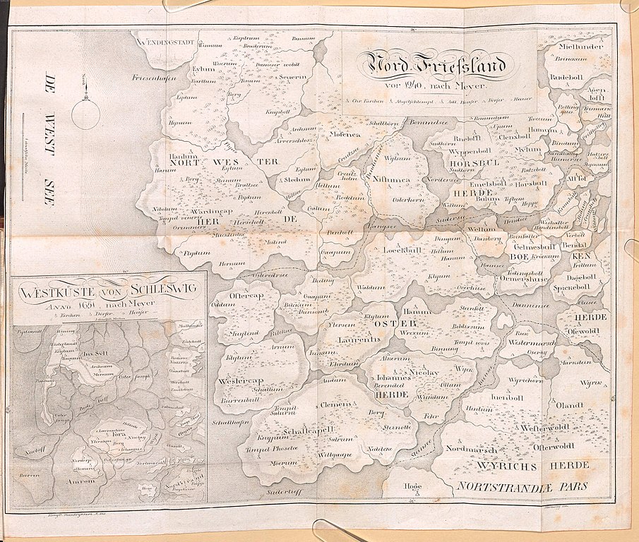
Deutsch: Karte von Nordfriesland. "NordFriesland vor 1240, nach Meyer", links unten mit Inset "Westküste von Schleswig Anno 1651, nach Meyer". Teil des Buches: Friedrich von Warnstedt: Die Insel Föhr und das Wilhelminen See-Bad, Schleswig 1824. |
| Date | 1824? (wie das Buch) |
| Source | |
| Author | Friedrich von Warnstedt |
Licensing
edit
|
This work is in the public domain in its country of origin and other countries and areas where the copyright term is the author's life plus 70 years or fewer. This work is in the public domain in the United States because it was published (or registered with the U.S. Copyright Office) before January 1, 1929. | |
| This file has been identified as being free of known restrictions under copyright law, including all related and neighboring rights. | |
File history
Click on a date/time to view the file as it appeared at that time.
| Date/Time | Thumbnail | Dimensions | User | Comment | |
|---|---|---|---|---|---|
| current | 09:22, 28 October 2018 | | 6,152 × 5,221 (3.5 MB) | Ratzer (talk | contribs) | Reverted to version as of 09:01, 28 October 2018 (UTC) |
| 09:21, 28 October 2018 |  | 4,098 × 3,478 (6.39 MB) | Ratzer (talk | contribs) | Reverted to version as of 12:26, 26 October 2018 (UTC) | |
| 09:01, 28 October 2018 |  | 6,152 × 5,221 (3.5 MB) | Ratzer (talk | contribs) | detailreicher, obwohl kleiner? (Quelle hier: http://bsb3.bsb.lrz.de/~db/1045/bsb10457414/images/150/bsb10457414_00021.jpg) | |
| 12:26, 26 October 2018 |  | 4,098 × 3,478 (6.39 MB) | Ratzer (talk | contribs) | User created page with UploadWizard |
You cannot overwrite this file.
File usage on Commons
There are no pages that use this file.
File usage on other wikis
The following other wikis use this file:
- Usage on de.wikipedia.org