File:North-Carolina-Population-Density-2008.png
Size of this preview: 800 × 303 pixels. Other resolutions: 320 × 121 pixels | 640 × 243 pixels | 1,280 × 485 pixels.
Original file (1,280 × 485 pixels, file size: 216 KB, MIME type: image/png)
Captions
Captions
Add a one-line explanation of what this file represents
Summary edit
| Description |
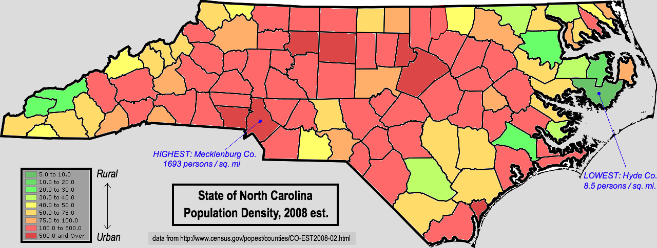
English: Map of North Carolina, using color shading to denote county-level population density using 2008 census estimates. Data retrieved from https://www.census.gov\/popest/counties/CO-EST2008-02.html |
| Date | |
| Source | I created this work entirely by myself. FWIW, though I live in Alabama now, I grew up in Vance County N.C. |
| Author | Nuberger13 (talk) |
Licensing edit
| This work has been released into the public domain by its author, Nuberger13 at English Wikipedia. This applies worldwide. In some countries this may not be legally possible; if so: Nuberger13 grants anyone the right to use this work for any purpose, without any conditions, unless such conditions are required by law. |
Original upload log edit
Transferred from en.wikipedia to Commons by Magnus Manske using CommonsHelper.
The original description page was here. All following user names refer to en.wikipedia.
- 2009-05-02 22:28 Nuberger13 1280×485× (221643 bytes) {{Information |Description = Map of North Carolina, using color shading to denote county-level population density using 2008 census estimates. Data retrieved from http://www.census.gov/popest/counties/CO-EST2008-02.html |Source = I created th
File history
Click on a date/time to view the file as it appeared at that time.
| Date/Time | Thumbnail | Dimensions | User | Comment | |
|---|---|---|---|---|---|
| current | 08:44, 21 February 2011 | 1,280 × 485 (216 KB) | File Upload Bot (Magnus Manske) (talk | contribs) | {{BotMoveToCommons|en.wikipedia|year={{subst:CURRENTYEAR}}|month={{subst:CURRENTMONTHNAME}}|day={{subst:CURRENTDAY}}}} {{Information |Description={{en|Map of North Carolina, using color shading to denote county-level population density using 2008 census |
You cannot overwrite this file.
File usage on Commons
There are no pages that use this file.
File usage on other wikis
The following other wikis use this file:
- Usage on ro.wikipedia.org