File:North Carolina 2021 Enacted Congressional Districts, 118th Congress (S.L. 2021-174).pdf

Size of this JPG preview of this PDF file: 800 × 518 pixels. Other resolutions: 320 × 207 pixels | 640 × 414 pixels | 1,024 × 663 pixels | 1,280 × 828 pixels | 2,550 × 1,650 pixels.
Original file (2,550 × 1,650 pixels, file size: 1.25 MB, MIME type: application/pdf)
Captions
Captions
Add a one-line explanation of what this file represents
Summary
edit| Description |
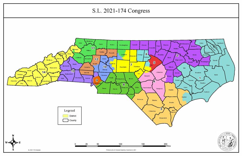
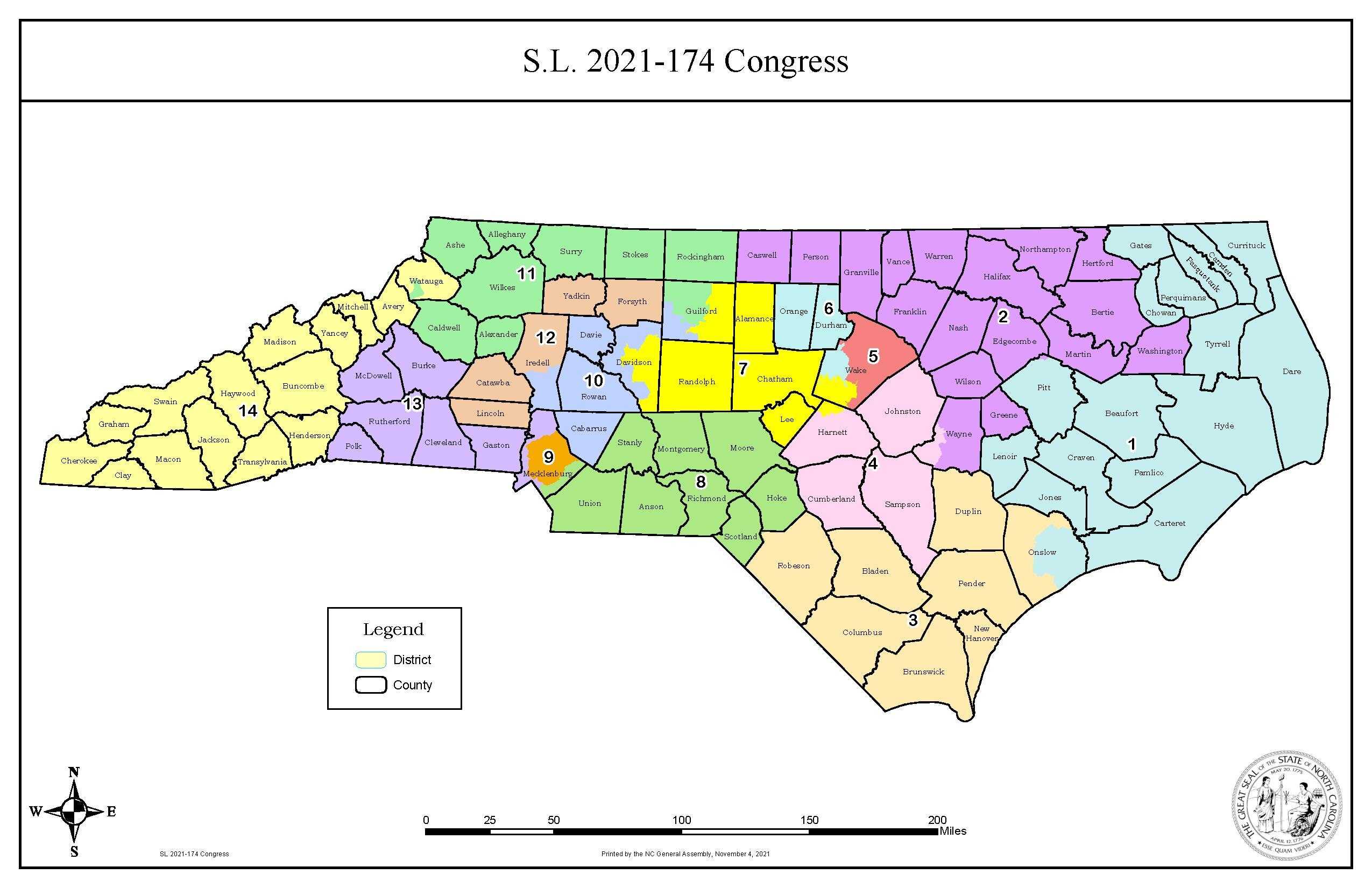
English: The congressional districts map of North Carolina (Senate Bill 740 / SL 2021-174/Congressional Redistricting Plan 2021/CST-13) ratified by the North Carolina General Assembly on November 4, 2021 and struck down by the North Carolina Supreme Court on February 4, 2022 |
| Date | |
| Source | https://web.archive.org/web/20220107085434/https://www.ncleg.gov/BillLookUp/2021/S740 |
| Author | North Carolina General Assembly |
Licensing
edit| This map is ineligible for copyright and therefore in the public domain, because it consists entirely of information that is common property and contains no original authorship. For more information, see Commons:Threshold of originality § Maps.
|
File history
Click on a date/time to view the file as it appeared at that time.
| Date/Time | Thumbnail | Dimensions | User | Comment | |
|---|---|---|---|---|---|
| current | 06:03, 13 January 2022 |  | 2,550 × 1,650 (1.25 MB) | Twotwofourtysix (talk | contribs) | Uploaded a work by North Carolina General Assembly from https://web.archive.org/web/20220107085434/https://www.ncleg.gov/BillLookUp/2021/S740 with UploadWizard |
You cannot overwrite this file.
File usage on Commons
The following 2 pages use this file: