File:North Stack bridge - geograph.org.uk - 1196180.jpg
No higher resolution available.
North_Stack_bridge_-_geograph.org.uk_-_1196180.jpg (640 × 480 pixels, file size: 67 KB, MIME type: image/jpeg)
Captions
Captions
Add a one-line explanation of what this file represents
Summary
edit
| Description |
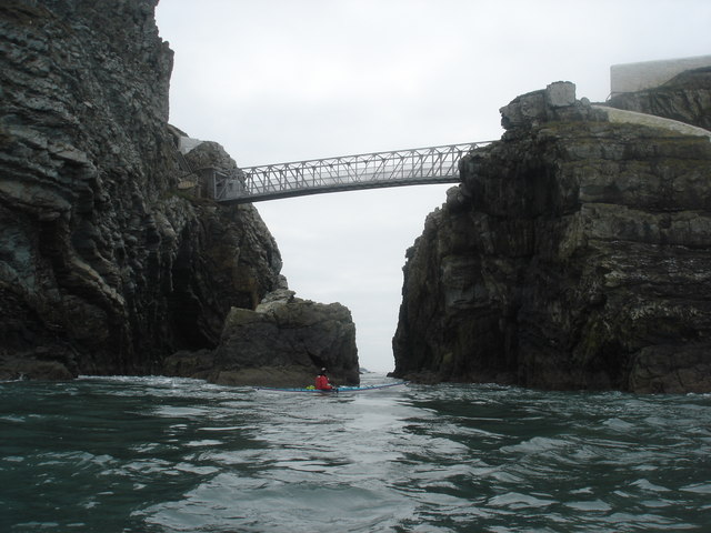
English: North Stack bridge This Swaledale Outdoor Club group had just paddled under the bridge between North Stack and Holy Island and had paused for photographs and to investigate the adjacent big cave. Clive Hall is looking back towards Gogarth Bay, as the tide flows towards the photographer, the flood tide now easing a little after carrying us very rapidly through Penrhyn Mawr. |
| Date | |
| Source | From geograph.org.uk |
| Author | Andy Waddington |
| Camera location | | View this and other nearby images on: OpenStreetMap |
|---|
_heading:180.00&language=en)
| Object location | | View this and other nearby images on: OpenStreetMap |
|---|
_heading:180.00&language=en)
Licensing
edit

|
This image was taken from the Geograph project collection. See this photograph's page on the Geograph website for the photographer's contact details. The copyright on this image is owned by Andy Waddington and is licensed for reuse under the Creative Commons Attribution-ShareAlike 2.0 license.
|
This file is licensed under the Creative Commons Attribution-Share Alike 2.0 Generic license.
Attribution: Andy Waddington
- You are free:
- to share – to copy, distribute and transmit the work
- to remix – to adapt the work
- Under the following conditions:
- attribution – You must give appropriate credit, provide a link to the license, and indicate if changes were made. You may do so in any reasonable manner, but not in any way that suggests the licensor endorses you or your use.
- share alike – If you remix, transform, or build upon the material, you must distribute your contributions under the same or compatible license as the original.
File history
Click on a date/time to view the file as it appeared at that time.
| Date/Time | Thumbnail | Dimensions | User | Comment | |
|---|---|---|---|---|---|
| current | 00:45, 26 February 2011 | | 640 × 480 (67 KB) | GeographBot (talk | contribs) | == {{int:filedesc}} == {{Information |description={{en|1=North Stack bridge This Swaledale Outdoor Club group had just paddled under the bridge between North Stack and Holy Island and had paused for photographs and to investigate the adjacent big cave. Cl |
You cannot overwrite this file.
File usage on Commons
There are no pages that use this file.