File:North West Leicestershire UK local election 2011 map.svg

Size of this PNG preview of this SVG file: 578 × 600 pixels. Other resolutions: 231 × 240 pixels | 463 × 480 pixels | 740 × 768 pixels | 987 × 1,024 pixels | 1,974 × 2,048 pixels | 1,220 × 1,266 pixels.
Original file (SVG file, nominally 1,220 × 1,266 pixels, file size: 489 KB)
Captions
Captions
Add a one-line explanation of what this file represents
Summary
edit
| Description |
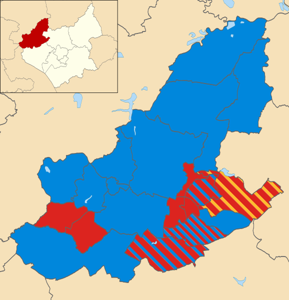
English: Map of North West Leicestershire, UK showing the results of the 2011 local election.
Colours: Conservative
Labour
Liberal Democrat |
| Date | |
| Source | File:North West Leicestershire UK ward map 2010 (blank).svg |
| Author | |
| Other versions | File:NWLeics 2011 Election Map.png |
.svg)
Licensing
edit
I, the copyright holder of this work, hereby publish it under the following licenses:

|
Permission is granted to copy, distribute and/or modify this document under the terms of the GNU Free Documentation License, Version 1.2 or any later version published by the Free Software Foundation; with no Invariant Sections, no Front-Cover Texts, and no Back-Cover Texts. A copy of the license is included in the section entitled GNU Free Documentation License. |
This file is licensed under the Creative Commons Attribution 3.0 Unported license.
- You are free:
- to share – to copy, distribute and transmit the work
- to remix – to adapt the work
- Under the following conditions:
- attribution – You must give appropriate credit, provide a link to the license, and indicate if changes were made. You may do so in any reasonable manner, but not in any way that suggests the licensor endorses you or your use.
You may select the license of your choice.
File history
Click on a date/time to view the file as it appeared at that time.
| Date/Time | Thumbnail | Dimensions | User | Comment | |
|---|---|---|---|---|---|
| current | 14:17, 22 February 2012 | | 1,220 × 1,266 (489 KB) | Zangar (talk | contribs) | {{Information |Description ={{en|1=Map of North West Leicestershire, UK showing the results of the 2011 local election. Colours: {{legend|#0087dc|Conservative}} {{legend|#dc241f|Labour}} {{legend|#fdbb30|Liberal Democrat}}}} |Source =[[:File:N |
You cannot overwrite this file.
File usage on Commons
The following page uses this file:
File usage on other wikis
The following other wikis use this file:
- Usage on en.wikipedia.org
- Usage on www.wikidata.org