File:Northeast somalia geography.gif
Size of this preview: 654 × 600 pixels. Other resolutions: 262 × 240 pixels | 524 × 480 pixels | 891 × 817 pixels.
Original file (891 × 817 pixels, file size: 109 KB, MIME type: image/gif)
Captions
Captions
Add a one-line explanation of what this file represents
Summary
edit
| Description |
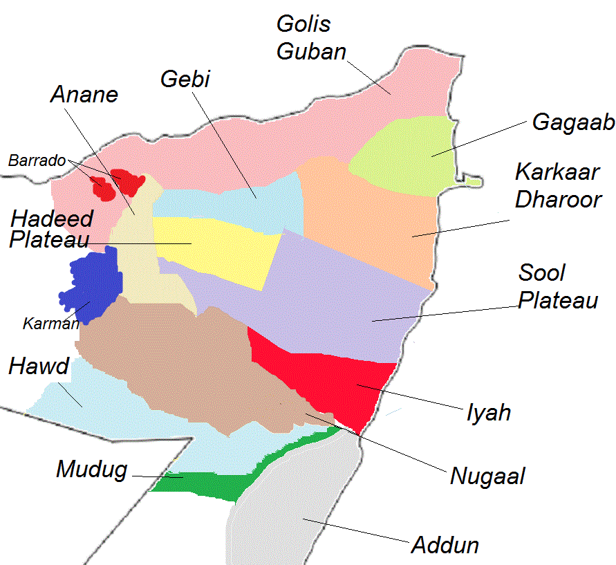
English: northeast somalia geography |
| Date | |
| Source | Own work background data from PROYECTOS QUE REQUIEREN LA APROBACIÓN DE LA JUNTA EJECUTIVA; Anane area data from colonial era descriptions from Lieutenant-Colonel H. Moyse-Bartlett (see); and northeastern (i.e. erigabo/barrado) data from a report from Hydrogeological Survey and Assessment of Selected Areas in Somaliland and Puntland (see) |
| Author | Deuthe suis dd |
Licensing
edit
I, the copyright holder of this work, hereby publish it under the following license:
This file is licensed under the Creative Commons Attribution-Share Alike 4.0 International license.
- You are free:
- to share – to copy, distribute and transmit the work
- to remix – to adapt the work
- Under the following conditions:
- attribution – You must give appropriate credit, provide a link to the license, and indicate if changes were made. You may do so in any reasonable manner, but not in any way that suggests the licensor endorses you or your use.
- share alike – If you remix, transform, or build upon the material, you must distribute your contributions under the same or compatible license as the original.
File history
Click on a date/time to view the file as it appeared at that time.
| Date/Time | Thumbnail | Dimensions | User | Comment | |
|---|---|---|---|---|---|
| current | 23:58, 18 June 2020 | | 891 × 817 (109 KB) | Deuthe suis dd (talk | contribs) | other geographic |
| 22:10, 18 June 2020 |  | 891 × 817 (105 KB) | Deuthe suis dd (talk | contribs) | Uploaded own work with UploadWizard |
You cannot overwrite this file.
File usage on Commons
The following page uses this file: