File:Norther wind farm, North Sea.jpg

Original file (3,506 × 2,540 pixels, file size: 1.89 MB, MIME type: image/jpeg)
Captions
Captions
Summary
edit
| Description |
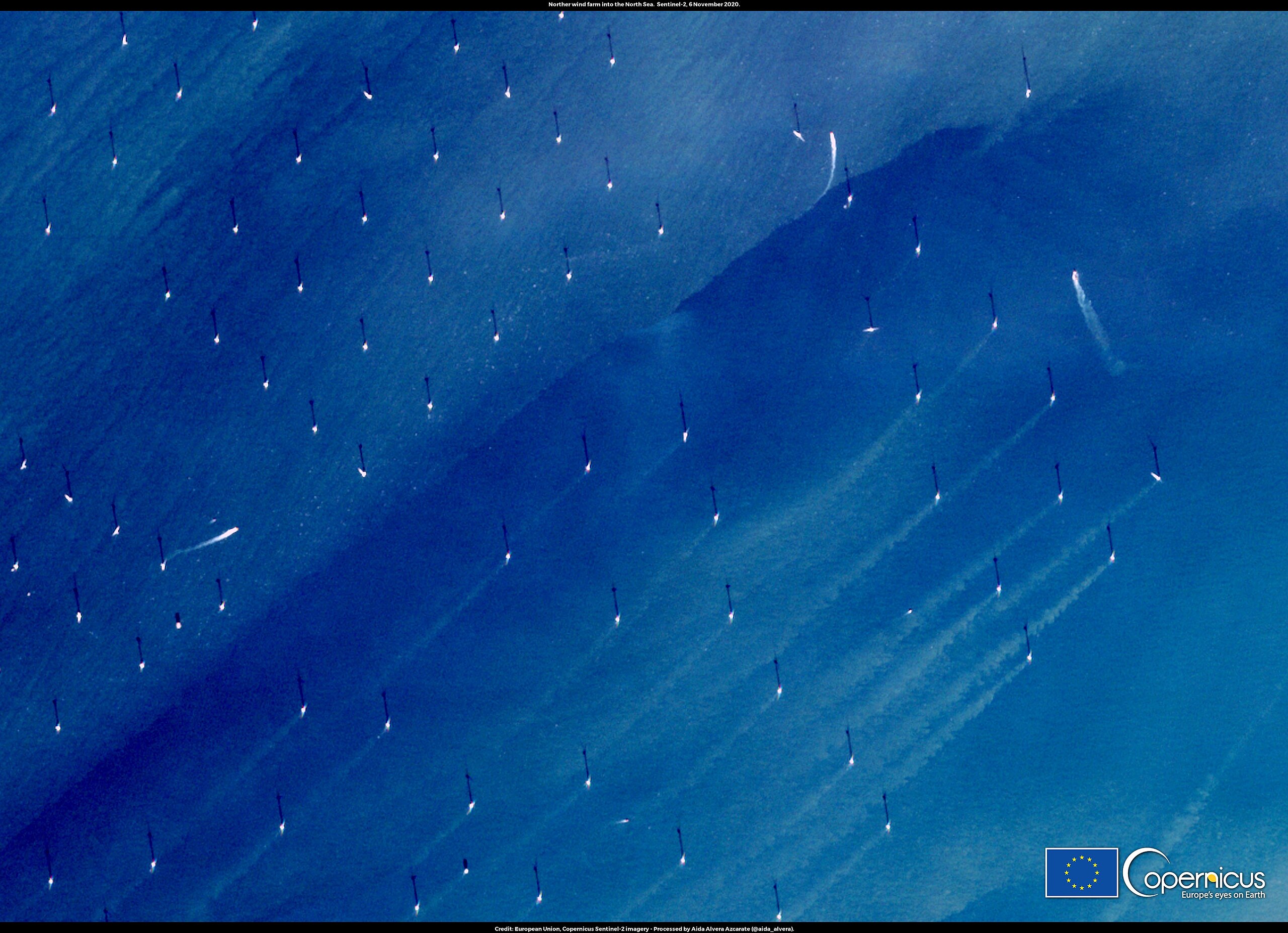
English: The development of offshore wind farms can in some cases impact coastal zones. For example, they can modify the sedimentary environment with potential consequences on the marine environment. Open Data from the Copernicus satellites and Marine Service enables to inform impact studies and deployment plans. This image, acquired by one of the Copernicus Sentinel-2 satellites on 6 November 2020, shows turbid sediment plumes generated by the offshore windmills of the Norther wind farm in the North Sea off the Belgian coast. The study of the ocean and suspended sediments dynamics generated by offshore wind farms is a research topic for Aida Alvera Azcarate, a researcher at the University of Liège, Belgium who provided this image The Copernicus Sentinel missions allow to monitor water quality and sediment transport in coastal areas. |
| Date | Taken on 6 November 2020 |
| Source | Norther wind farm, North Sea |
| Author | European Union , Copernicus Sentinel-2 imagery |
Licensing
edit

|
This image contains data from a satellite in the Copernicus Programme, such as Sentinel-1, Sentinel-2 or Sentinel-3. Attribution is required when using this image.
Attribution: Contains modified Copernicus Sentinel data 2020
The use of Copernicus Sentinel Data is regulated under EU law (Commission Delegated Regulation (EU) No 1159/2013 and Regulation (EU) No 377/2014). Relevant excerpts:
Free access shall be given to GMES dedicated data [...] made available through GMES dissemination platforms [...].
Access to GMES dedicated data [...] shall be given for the purpose of the following use in so far as it is lawful:
GMES dedicated data [...] may be used worldwide without limitations in time.
GMES dedicated data and GMES service information are provided to users without any express or implied warranty, including as regards quality and suitability for any purpose. |
File history
Click on a date/time to view the file as it appeared at that time.
| Date/Time | Thumbnail | Dimensions | User | Comment | |
|---|---|---|---|---|---|
| current | 15:13, 24 August 2023 | | 3,506 × 2,540 (1.89 MB) | OptimusPrimeBot (talk | contribs) | #Spacemedia - Upload of https://www.copernicus.eu/system/files/2020-12/image_day/NortherWindFarm.jpg via Commons:Spacemedia |
You cannot overwrite this file.
File usage on Commons
There are no pages that use this file.