File:Norton Malreward.jpg
Original file (3,888 × 2,592 pixels, file size: 6.14 MB, MIME type: image/jpeg)
Captions
Captions
| Description |
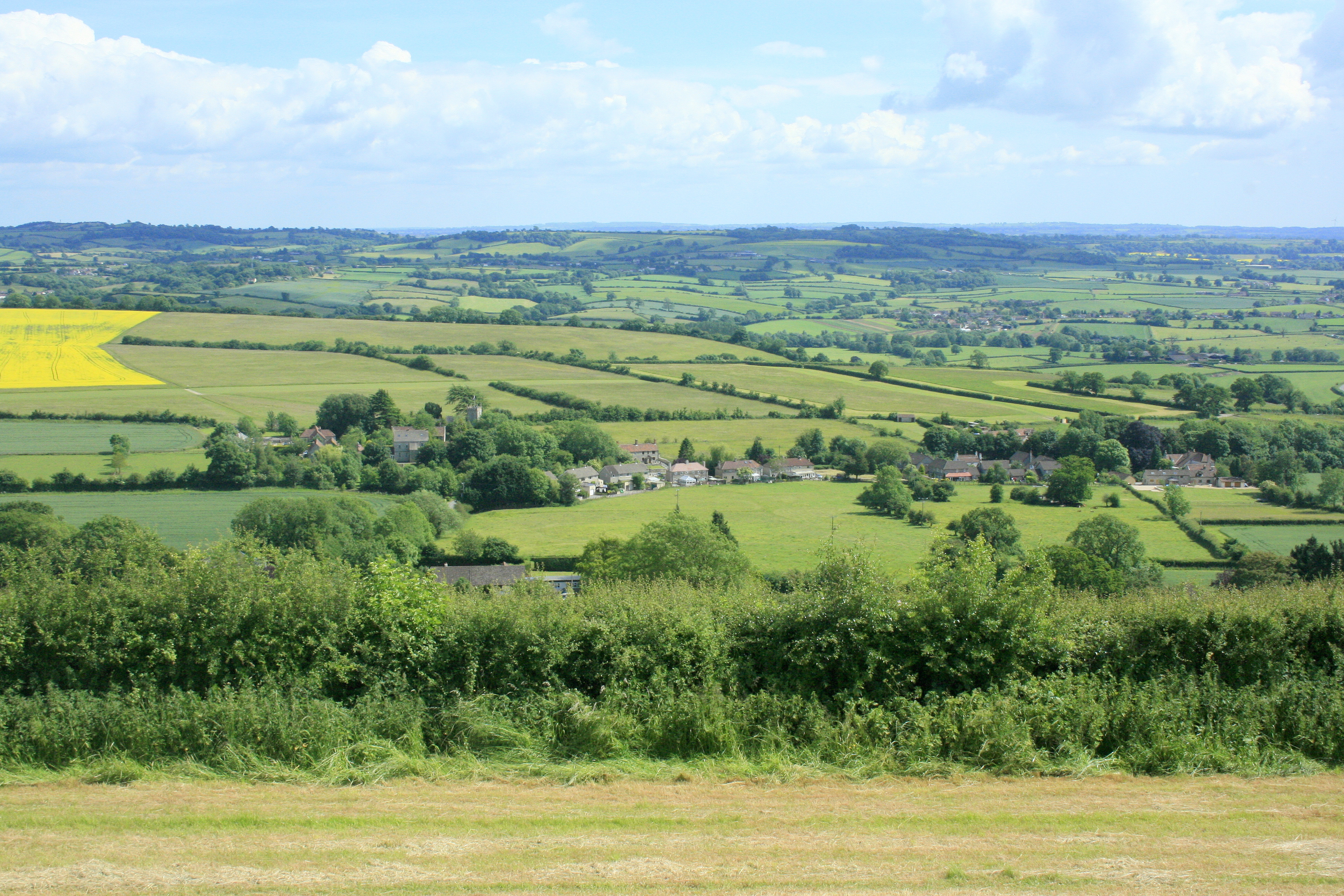
English: Norton Malreward from Maes Knoll. Turning right from 1383481 and facing almost due south, Norton Malreward appears, its parish church can be seen among the trees.
An interesting story is told in: http://www.themodernantiquarian.com/post/39162/maes_knoll.html "This [Maes Knoll] is where Hautville's Quoit was thrown from, by Sir John Haut(e)ville (you can read more about this on the Hautville's Quoit page). He was just rehearsing for a throwing match with the Devil, which he ended up winning by throwing a rock from Shute Shelve to Compton Bishop (about a mile and a half) - the Devil threw 3 furlongs shorter. (from Grinsell's folklore book I think). Sir John is apparently bured [sic] in Chew Magna church, where there's an oak effigy of him. This gentleman was remarkable for prodigious strength, as the Irish oak is probably intended to denote. Vulgar tradition informs us, that Edward the First having requested Sir John to shew him a specimen of his abilities, the knight undertook to convey three of the stoutest men in England to the top of Norton Tower [Norton Malreward is at the foot of Maes Knoll], situated in a neighbouring parish. Accordingly, taking one under each arm, and a third in his teeth, he proceeded on his task. The two in his arms, making some resistance, were squeezed to death, but the other was carried up without sustaining the smallest injury" |
| Date | |
| Source | From geograph.org.uk |
| Author | Maurice Pullin |
| Permission (Reusing this file) |
Creative Commons Attribution Share-alike license 2.0 |
| Camera location | | View this and other nearby images on: OpenStreetMap |
|---|
Licensing
edit

|
This image was taken from the Geograph project collection. See this photograph's page on the Geograph website for the photographer's contact details. The copyright on this image is owned by Maurice Pullin and is licensed for reuse under the Creative Commons Attribution-ShareAlike 2.0 license.
|
- You are free:
- to share – to copy, distribute and transmit the work
- to remix – to adapt the work
- Under the following conditions:
- attribution – You must give appropriate credit, provide a link to the license, and indicate if changes were made. You may do so in any reasonable manner, but not in any way that suggests the licensor endorses you or your use.
- share alike – If you remix, transform, or build upon the material, you must distribute your contributions under the same or compatible license as the original.
File history
Click on a date/time to view the file as it appeared at that time.
| Date/Time | Thumbnail | Dimensions | User | Comment | |
|---|---|---|---|---|---|
| current | 23:11, 8 September 2017 | | 3,888 × 2,592 (6.14 MB) | Geograph Update Bot (talk | contribs) | Higher-resolution version from Geograph. |
| 09:42, 4 October 2009 |  | 640 × 427 (150 KB) | Rodw (talk | contribs) | {{Information |Description=Norton Malreward from Maes Knoll |Source=From [http://www.geograph.org.uk/photo/1384392 geograph.org.uk] |Date=2009-06-16 |Author=[http://www.geograph.org.uk/profile/14368 Maurice Pullin] |Permission=Creative Commons Attribution |
You cannot overwrite this file.
File usage on Commons
The following 2 pages use this file:
File usage on other wikis
The following other wikis use this file:
- Usage on ceb.wikipedia.org
- Usage on en.wikipedia.org
- Usage on fr.wikipedia.org
- Usage on lld.wikipedia.org
- Usage on pl.wikipedia.org
- Usage on tr.wikipedia.org
- Usage on www.wikidata.org
- Usage on zh-min-nan.wikipedia.org