File:Nyctalus plancyi distribution map.png
Size of this preview: 621 × 600 pixels. Other resolutions: 248 × 240 pixels | 497 × 480 pixels | 795 × 768 pixels | 1,060 × 1,024 pixels | 1,623 × 1,568 pixels.
Original file (1,623 × 1,568 pixels, file size: 3.23 MB, MIME type: image/png)
Captions
Captions
Add a one-line explanation of what this file represents
Summary
edit
| Description |
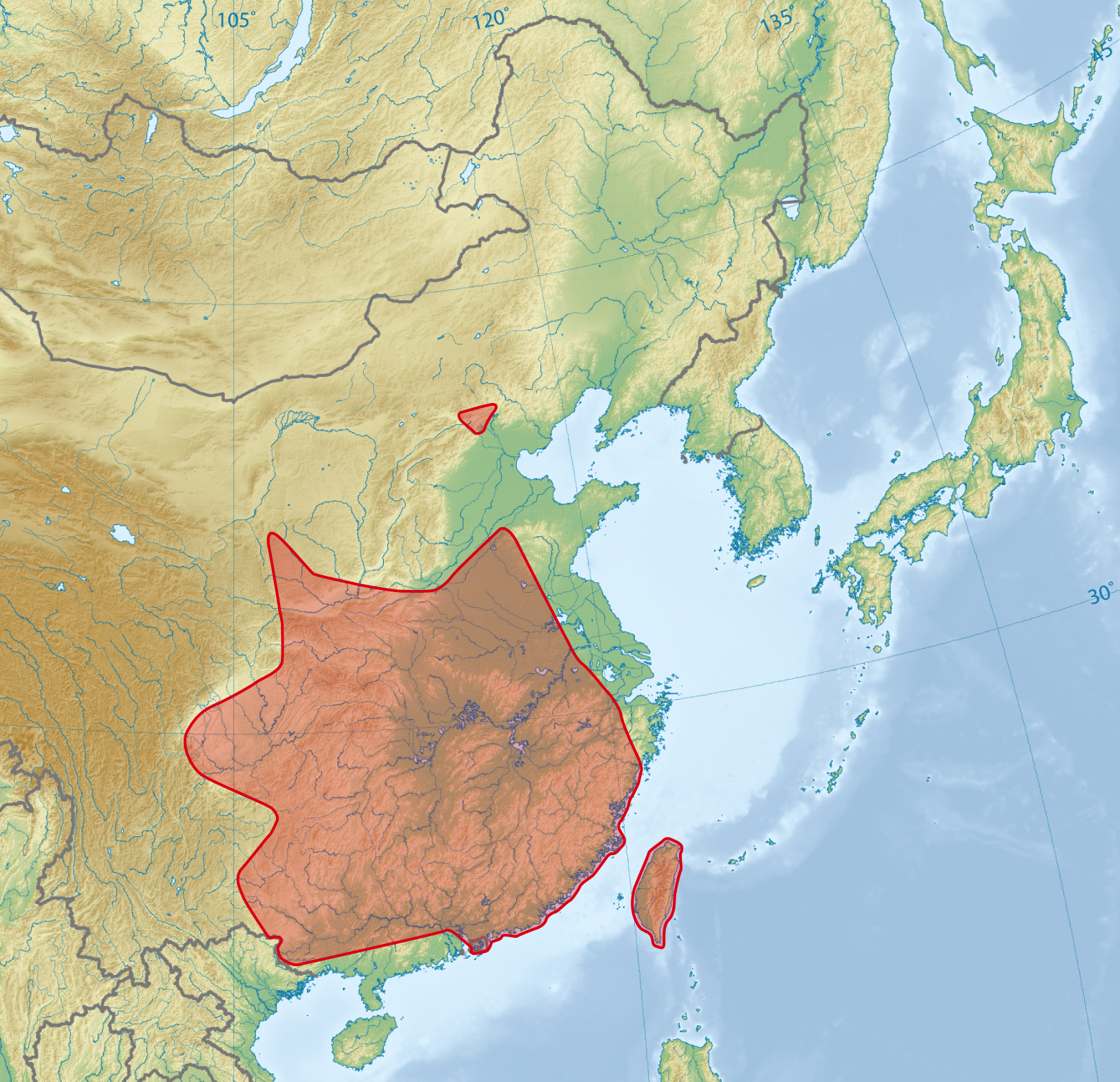
Nyctalus plancyi Deutsch: Verbreitungskarte des Chinesischen Abendseglers English: Distribution map of the Chinese Noctule |
| Date | |
| Source |
This file was derived from: East Asia topographic map.png |
| Author |
|

|
This map has been made or improved in the German Kartenwerkstatt (Map Lab). You can propose maps to improve as well.
|
Licensing
edit
This file is licensed under the Creative Commons Attribution-Share Alike 3.0 Unported license.
- You are free:
- to share – to copy, distribute and transmit the work
- to remix – to adapt the work
- Under the following conditions:
- attribution – You must give appropriate credit, provide a link to the license, and indicate if changes were made. You may do so in any reasonable manner, but not in any way that suggests the licensor endorses you or your use.
- share alike – If you remix, transform, or build upon the material, you must distribute your contributions under the same or compatible license as the original.
Original upload log
edit
This image is a derivative work of the following images:
- File:East_Asia_topographic_map.png licensed with Cc-by-sa-3.0-migrated, GFDL-GMT
- 2008-08-17T05:11:19Z Ksiom 2876x2094 (9245630 Bytes) {{Information |Description={{en|1=Topographic map of East Asia.}} {{ko|1=동아시아의 지형도.}} |Source=Own work by uploader |Author=[[User:Ksiom|Ksiom]] |Date=2008-08-17 |Permission={{GFDL-GMT}} |other_versions= }} [
File history
Click on a date/time to view the file as it appeared at that time.
| Date/Time | Thumbnail | Dimensions | User | Comment | |
|---|---|---|---|---|---|
| current | 17:52, 21 September 2012 | | 1,623 × 1,568 (3.23 MB) | NordNordWest (talk | contribs) | == {{int:filedesc}} == {{Information |Description=''Nyctalus plancyi'' {{de|Verbreitungskarte}} {{en|Distribution map}} |Source={{Derived from|East_Asia_topographic_map.png}} * http://maps.iucnredlist.org/map.html?id=136828 |Date=2012-09-21 17:50 (... |
You cannot overwrite this file.
File usage on Commons
The following page uses this file:
File usage on other wikis
The following other wikis use this file:
- Usage on avk.wikipedia.org
- Usage on bg.wikipedia.org
- Usage on ca.wikipedia.org
- Usage on ceb.wikipedia.org
- Usage on de.wikipedia.org
- Usage on en.wikipedia.org
- Usage on eu.wikipedia.org
- Usage on ko.wikipedia.org
- Usage on nl.wikipedia.org
- Usage on pt.wikipedia.org
- Usage on sv.wikipedia.org
- Usage on uk.wikipedia.org
- Usage on vi.wikipedia.org
- Usage on www.wikidata.org
- Usage on zh.wikipedia.org