File:O'Hare International Airport (USGS) Phase2.png
Size of this preview: 600 × 600 pixels. Other resolutions: 240 × 240 pixels | 480 × 480 pixels | 768 × 768 pixels | 1,132 × 1,132 pixels.
Original file (1,132 × 1,132 pixels, file size: 2.56 MB, MIME type: image/png)
Captions
Captions
Add a one-line explanation of what this file represents
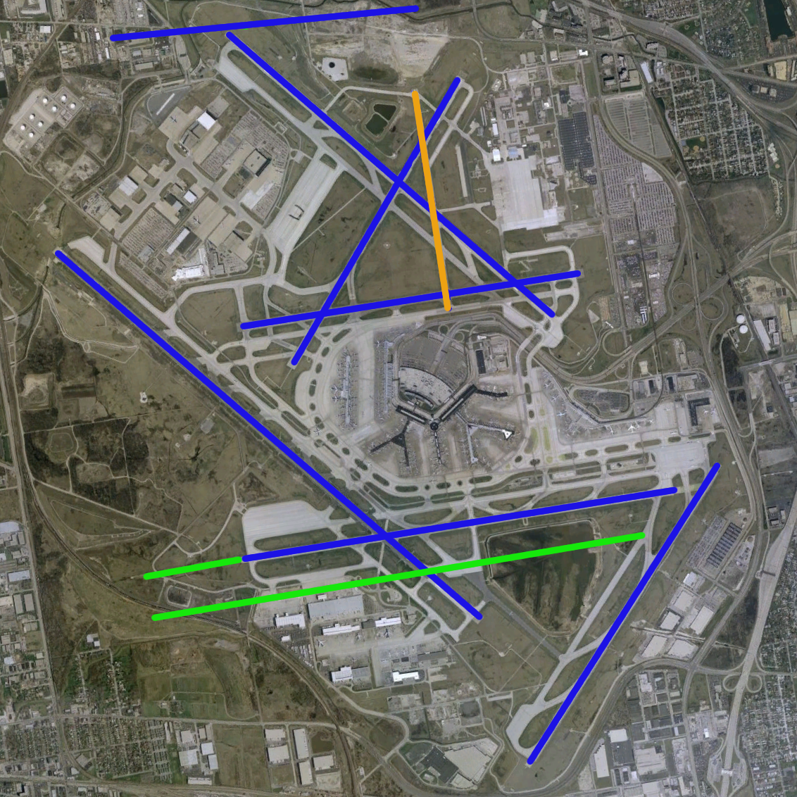
| Description | O'Hare International Airport modernization program - phase 2 runway configuration (blue = existing, green = new, orange = removed) | |||
| Source | NASA World Wind Screenshot, USGS urban ortho; [1] | |||
| Author |
Runway overlay by User:Wangi |
|||
| Other versions | Image:O'Hare International Airport (USGS).png, Image:O'Hare International Airport (USGS) Current.png, Image:O'Hare International Airport (USGS) Phase1.png, Image:O'Hare International Airport (USGS) Phase3.png, Image:O'Hare International Airport (USGS) Final.png |
.png)
_Current.png)
_Phase1.png)
_Phase3.png)
_Final.png)
File history
Click on a date/time to view the file as it appeared at that time.
| Date/Time | Thumbnail | Dimensions | User | Comment | |
|---|---|---|---|---|---|
| current | 09:58, 14 May 2006 | | 1,132 × 1,132 (2.56 MB) | Wangi (talk | contribs) | {{Information| |Description=O'Hare International Airport modernization program - phase 2 runway configuration (blue = existing, green = new, orange = removed) |Source=NASA World Wind Screenshot, USGS urban ortho; [http://egov.cityofchicago.org/city/we |
You cannot overwrite this file.
File usage on Commons
There are no pages that use this file.
File usage on other wikis
The following other wikis use this file:
- Usage on en.wikipedia.org
_Phase2.png&oldid=656322454)