File:Obcine Slovenija 2006 Sentrupert.svg

Size of this PNG preview of this SVG file: 800 × 522 pixels. Other resolutions: 320 × 209 pixels | 640 × 418 pixels | 1,024 × 668 pixels | 1,280 × 835 pixels | 2,560 × 1,670 pixels | 2,613 × 1,705 pixels.
Original file (SVG file, nominally 2,613 × 1,705 pixels, file size: 2.36 MB)
Captions
Captions
Add a one-line explanation of what this file represents
Summary edit
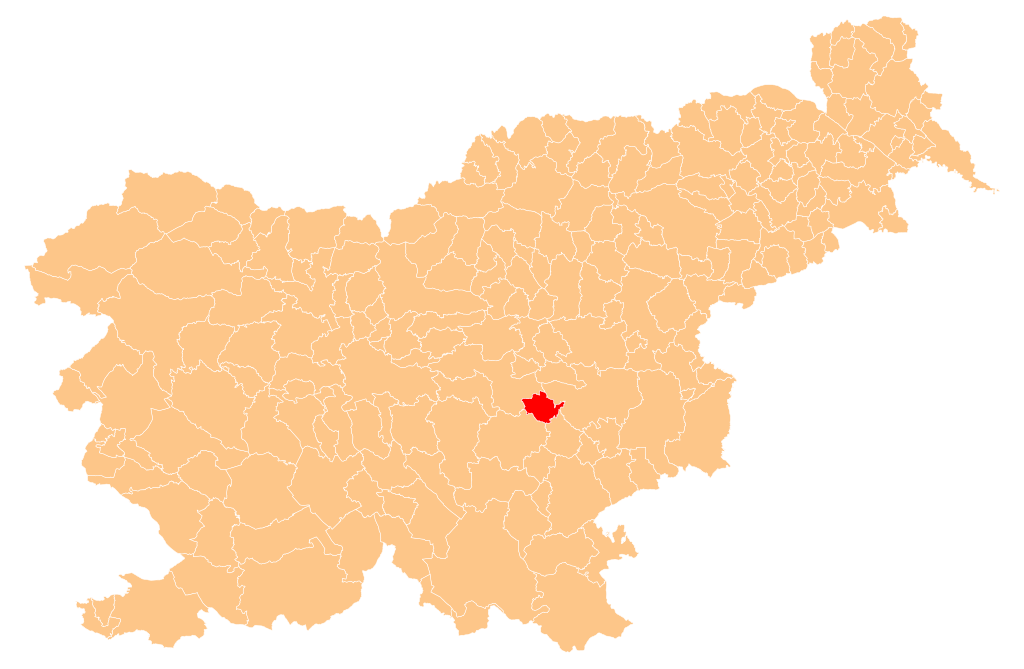
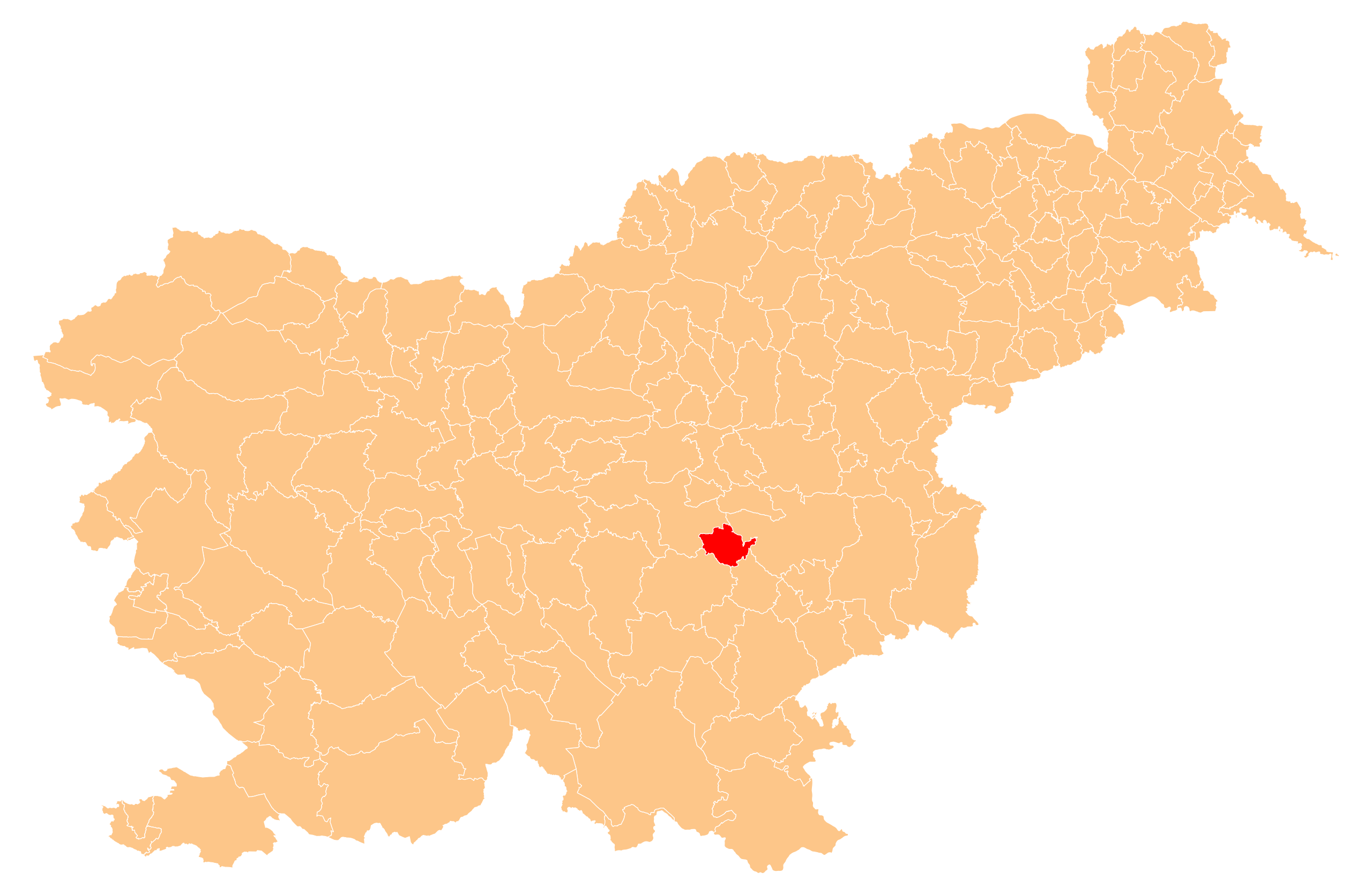
| Description | Občina Šentrupert (marked red) on map of the municipalities (občine) of the Republic of Slovenia, as since May 2006 (210 units). |
| Date | |
| Source | Manipulated Image:Obcine Slovenija 2006.svg in text editor. |
| Author | Source of the public data is GURS (Geodetska uprava Republike Slovenije or Surveying and Mapping Authority of the Republic of Slovenia). Converted from Shapefile to SVG with shp2svg and prepared for Wikipedia by romanm (talk). |
| Permission (Reusing this file) |
Public domain. See Image:Obcine Slovenija 2006.svg for an explanation. |
Licensing edit
| I, the copyright holder of this work, release this work into the public domain. This applies worldwide. In some countries this may not be legally possible; if so: I grant anyone the right to use this work for any purpose, without any conditions, unless such conditions are required by law. |
File history
Click on a date/time to view the file as it appeared at that time.
| Date/Time | Thumbnail | Dimensions | User | Comment | |
|---|---|---|---|---|---|
| current | 21:42, 3 November 2008 | | 2,613 × 1,705 (2.36 MB) | Romanm (talk | contribs) | == Povzetek == {{Information |Description=''Občina Šentrupert'' (marked red) on map of the municipalities (''občine'') of the Republic of Slovenia, as since May 2006 (211 units). |Source=Manipulated Image:Obcine Slovenija 2006.svg in text editor. |
You cannot overwrite this file.
File usage on Commons
The following 2 pages use this file:
File usage on other wikis
The following other wikis use this file:
- Usage on cs.wikipedia.org
- Usage on de.wikipedia.org
- Usage on en.wikipedia.org
- Šentrupert
- Template:Šentrupert
- Barbo Manor
- Zaloka
- Bistrica, Šentrupert
- Brinje, Šentrupert
- Dolenje Jesenice
- Draga pri Šentrupertu
- Gorenje Jesenice
- Hom, Šentrupert
- Hrastno
- Kamnje, Šentrupert
- Kostanjevica, Šentrupert
- Mali Cirnik pri Šentjanžu
- Okrog, Šentrupert
- Prelesje, Šentrupert
- Ravne nad Šentrupertom
- Rakovnik pri Šentrupertu
- Ravnik, Šentrupert
- Roženberk
- Slovenska Vas, Šentrupert
- Straža, Šentrupert
- Škrljevo, Šentrupert
- Trstenik, Šentrupert
- Vesela Gora
- Vrh, Šentrupert
- Zabukovje, Šentrupert
- Vida Brest
- Pilgrims' Trail (Slovenia)
- Simončič Hayrack
- Municipality of Šentrupert
- Usage on eo.wikipedia.org
- Usage on hr.wikipedia.org
- Usage on id.wikipedia.org
- Usage on it.wikipedia.org
- Usage on ko.wikipedia.org
- Usage on nl.wikipedia.org
- Usage on pl.wikipedia.org
- Usage on pt.wikipedia.org
- Usage on ro.wikipedia.org
- Usage on ru.wikipedia.org
- Usage on sh.wikipedia.org
- Usage on sl.wikipedia.org
- Usage on sr.wikipedia.org
- Usage on tt.wikipedia.org
View more global usage of this file.