File:Obcine Slovenija 2007 Ajdovscina.svg

Size of this PNG preview of this SVG file: 800 × 522 pixels. Other resolutions: 320 × 209 pixels | 640 × 418 pixels | 1,024 × 668 pixels | 1,280 × 835 pixels | 2,560 × 1,670 pixels | 2,613 × 1,705 pixels.
Original file (SVG file, nominally 2,613 × 1,705 pixels, file size: 2.36 MB)
Captions
Captions
Add a one-line explanation of what this file represents
Summary
edit
| Description |
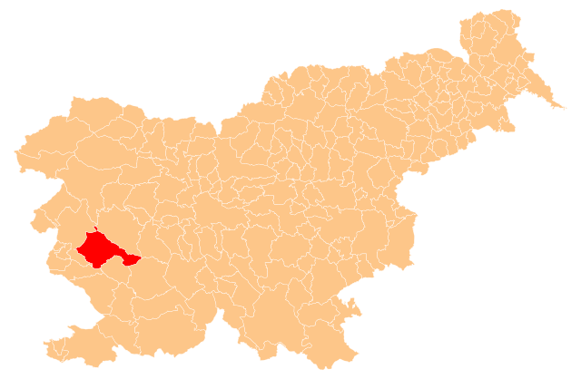
English: Občina Ajdovščina (marked red) on map of the municipalities (občine) of the Republic of Slovenia, as since May 2006 (210 units). |
| Date | |
| Source | Manipulated Image:Obcine Slovenija 2006.svg in text editor. |
| Author | Source of the public data is GURS (Geodetska uprava Republike Slovenije or Surveying and Mapping Authority of the Republic of Slovenia). Converted from Shapefile to SVG with shp2svg and prepared for Wikipedia by romanm (talk). |
| Permission (Reusing this file) |
Public domain. See Image:Obcine Slovenija 2006.svg for an explanation. |
Licensing
edit
| I, the copyright holder of this work, release this work into the public domain. This applies worldwide. In some countries this may not be legally possible; if so: I grant anyone the right to use this work for any purpose, without any conditions, unless such conditions are required by law. |
File history
Click on a date/time to view the file as it appeared at that time.
| Date/Time | Thumbnail | Dimensions | User | Comment | |
|---|---|---|---|---|---|
| current | 21:04, 8 November 2009 | | 2,613 × 1,705 (2.36 MB) | Romanm (talk | contribs) | correct version - previous was invalid |
| 20:59, 8 November 2009 |  | 2,613 × 1,705 (621 KB) | Romanm (talk | contribs) | {{Information |Description={{en|1=''Občina Ajdovščina'' (marked red) on map of the municipalities (''občine'') of the Republic of Slovenia, as since May 2006 (210 units).}} |Source=Manipulated Image:Obcine Slovenija 2006.svg in text editor. |Auth |
You cannot overwrite this file.
File usage on Commons
The following page uses this file:
File usage on other wikis
The following other wikis use this file:
- Usage on bg.wikipedia.org
- Шаблон:Община Айдовшчина
- Батуе
- Бела (община Айдовшчина)
- Бре (Словения)
- Айдовшчина
- Будане
- Велике Жабле
- Випавски Криж
- Вишне (община Айдовшчина)
- Водице (община Айдовшчина)
- Врътовче
- Врътовин
- Габере (община Айдовшчина)
- Гозд (община Айдовшчина)
- Гояче
- Гривче
- Добравле (община Айдовшчина)
- Долга Поляна
- Долене (община Айдовшчина)
- Завино
- Жаголич
- Жапуже
- Камне (община Айдовшчина)
- Ковк (община Айдовшчина)
- Кожмани
- Крижна гора (община Айдовшчина)
- Локавец (община Айдовшчина)
- Мале Жабле
- Мало Поле
- Маловше
- Отлица
- Планина (община Айдовшчина)
- Плаче
- Подкрай (община Айдовшчина)
- Поточе (община Айдовшчина)
- Предмея
- Равне (община Айдовшчина)
- Село (община Айдовшчина)
- Скриле
- Стомаж (община Айдовшчина)
- Тевче (община Айдовшчина)
- Усте
- Цеста (община Айдовшчина)
- Цол (селище)
- Чърнице
- Шмаре (община Айдовшчина)
- Айдовшчина (община)
- Usage on ca.wikipedia.org
- Usage on en.wikipedia.org
View more global usage of this file.