File:Obercarsdorf Reichstädt Grenze.jpg

Size of this preview: 600 × 600 pixels. Other resolutions: 240 × 240 pixels | 480 × 480 pixels | 768 × 768 pixels | 1,024 × 1,024 pixels | 2,048 × 2,048 pixels | 5,120 × 5,120 pixels.
Original file (5,120 × 5,120 pixels, file size: 4.56 MB, MIME type: image/jpeg)
Captions
Captions
Add a one-line explanation of what this file represents
Summary
edit
| Description |
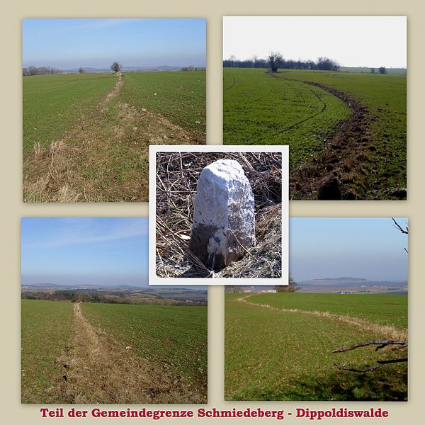
Deutsch: Grenzverlauf der Gemeindegrenze Schmiedeberg-Dippoldiswalde – hier Teilstück Obercarsdorf-Reichstädt. Dieser Grenzstreifen war zu DDR- und LPG-Zeiten ca. ein 3 m breiter Wiesen- und Gebüschstreifen. Die Gemeinde Schmiedeberg wird voraussichtlich 2014 zur Stadt Dippoldiswalde gehören. Ob dann dieser "Rest" noch Bestand haben wird? |
| Source | Own work |
| Author | Geri-oc |
| Openstreetmap entry | Link to Openstreetmap |
| Object location | | View this and other nearby images on: OpenStreetMap |
|---|
| Camera location | | View this and other nearby images on: OpenStreetMap |
|---|
Licensing
edit
Geri-oc, the copyright holder of this work, hereby publishes it under the following license:
This file is licensed under the Creative Commons Attribution-Share Alike 3.0 Germany license.
Attribution: Geri-oc
- You are free:
- to share – to copy, distribute and transmit the work
- to remix – to adapt the work
- Under the following conditions:
- attribution – You must give appropriate credit, provide a link to the license, and indicate if changes were made. You may do so in any reasonable manner, but not in any way that suggests the licensor endorses you or your use.
- share alike – If you remix, transform, or build upon the material, you must distribute your contributions under the same or compatible license as the original.

File history
Click on a date/time to view the file as it appeared at that time.
| Date/Time | Thumbnail | Dimensions | User | Comment | |
|---|---|---|---|---|---|
| current | 07:49, 1 April 2013 | | 5,120 × 5,120 (4.56 MB) | Geri-oc (talk | contribs) | {{Information |Description ={{de|1=Grenzverlauf der Gemeindegrenze Schmiedeberg-Dippoldiswalde - hier Teilstück Obercarsdorf-Reichstädt. Dieser Grenzstreifen war zu "DDR" - und "LPG" - Zeiten ca. ein 3 m breiter Wiesen- und Gebüschstreifen. Die G... |
You cannot overwrite this file.
File usage on Commons
The following page uses this file: