File:Occitania map (1).png

Size of this preview: 800 × 531 pixels. Other resolutions: 320 × 212 pixels | 640 × 425 pixels | 1,024 × 679 pixels | 1,435 × 952 pixels.
Original file (1,435 × 952 pixels, file size: 313 KB, MIME type: image/png)
Captions
Captions
Add a one-line explanation of what this file represents
Summary
edit.png&action=edit§ion=1)
| Description |
Occitan : Mapa d'Occitània facha per Cedric31 26 d'oct de 2008 a 11:33 (UTC) a partir de |
| Date | 26 October 2008 (original upload date) |
| Source | Transferred from oc.wikipedia to Commons. |
| Author | The original uploader was Cedric31 at Occitan Wikipedia. |
Licensing
edit.png&action=edit§ion=2)
This file is licensed under the Creative Commons Attribution-Share Alike 2.5 Generic license.
- You are free:
- to share – to copy, distribute and transmit the work
- to remix – to adapt the work
- Under the following conditions:
- attribution – You must give appropriate credit, provide a link to the license, and indicate if changes were made. You may do so in any reasonable manner, but not in any way that suggests the licensor endorses you or your use.
- share alike – If you remix, transform, or build upon the material, you must distribute your contributions under the same or compatible license as the original.
Original upload log
edit.png&action=edit§ion=3)
The original description page was here. All following user names refer to oc.wikipedia.
| Date/Time | Dimensions | User | Comment |
|---|---|---|---|
| 2008-10-26 11:33 | 448×299× (56108 bytes) | Cedric31 | Mapa d'Occitània facha per ~~~~ a partir de [[:Image:France location map-Regions and departements.svg]] |
File history
Click on a date/time to view the file as it appeared at that time.
| Date/Time | Thumbnail | Dimensions | User | Comment | |
|---|---|---|---|---|---|
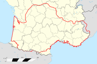
| current | 06:51, 15 June 2016 | | 1,435 × 952 (313 KB) | GosGroc (talk | contribs) | Límits d'Occitània en vermell gruixut. |
| 09:18, 11 June 2016 |  | 1,435 × 952 (311 KB) | GosGroc (talk | contribs) | New region borders and legend. 2016 | |
| 16:07, 15 September 2015 |  | 448 × 299 (55 KB) | Toislex (talk | contribs) | Transferred from oc.wikipedia |
You cannot overwrite this file.
File usage on Commons
There are no pages that use this file.
File usage on other wikis
The following other wikis use this file:
- Usage on eu.wikipedia.org
- Usage on oc.wikipedia.org
- Limòtges
- Tolosa
- Sent Iriès
- Solenhac
- Lo Vijan
- Cosés
- Isla (Nauta Vinhana)
- Lu Palaiç
- Aurèlh
- Festiac
- Panasòu
- Sent Just (Lemosin)
- Pau
- Baiona
- Auloron
- Bordèu
- Lengon
- L'Esparra
- Liborna
- Dacs
- Agen
- Vilanuèva d'Òut
- Marmanda
- Nerac
- Aush
- Condòm
- Miranda (Gers)
- Sent Gaudenç
- Murèth
- Tarba
- Argelèrs de Gasòst
- Vichèi
- Privàs
- L'Argentèira
- Tornon (Vivarés)
- Rodés
- Milhau
- Vilafranca de Roergue
- Carcassona
- Narbona
- Limós
- Gap
- Briançon
- Barcilona (Provença)
- Castelana
- Niça
- Marselha
- Ais
View more global usage of this file.
.png)
.png&oldid=452151683)