File:Ochsental16.jpg

Size of this preview: 450 × 600 pixels. Other resolutions: 180 × 240 pixels | 360 × 480 pixels | 576 × 768 pixels | 768 × 1,024 pixels | 1,536 × 2,048 pixels | 3,000 × 4,000 pixels.
Original file (3,000 × 4,000 pixels, file size: 2.83 MB, MIME type: image/jpeg)
Captions
Captions
Add a one-line explanation of what this file represents
Summary edit
| Description |
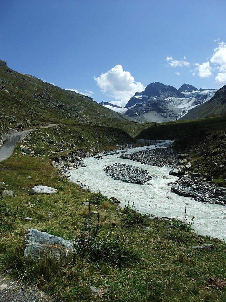
English: The Silvretta Reservoir is situated in the westernmost federal state Vorarlberg of Austria. From there the Ochsental runs south to the Silvretta Alps. View to the headwater of the Ill River. Deutsch: Der Silvretta-Stausee liegt im Bundesland Vorarlberg im äußersten Westen Österreichs. Von hier ausgehend verläuft das Ochsental nach Süden. Im Bild: Blick zum Oberlauf des Ill und zu den Silvretta-Alpen. |
| Date | |
| Source | Own work |
| Author | Nikater |
| Permission (Reusing this file) |
Own work, all rights released (Public domain) |
| Camera location | | View this and other nearby images on: OpenStreetMap |
|---|
Licensing edit
| I, the copyright holder of this work, release this work into the public domain. This applies worldwide. In some countries this may not be legally possible; if so: I grant anyone the right to use this work for any purpose, without any conditions, unless such conditions are required by law. |
| Annotations | This image is annotated: View the annotations at Commons |
File history
Click on a date/time to view the file as it appeared at that time.
| Date/Time | Thumbnail | Dimensions | User | Comment | |
|---|---|---|---|---|---|
| current | 21:01, 1 May 2012 | | 3,000 × 4,000 (2.83 MB) | Nikater (talk | contribs) | == {{int:filedesc}} == {{Information |Description={{en|1=The Silvretta Reservoir is situated in the westernmost federal state Vorarlberg of Austria. From there the Ochsental runs south to the Silvretta Alps. View to the headwater... |
You cannot overwrite this file.
File usage on Commons
There are no pages that use this file.