File:October 3, 2015 US East Coast nor'easter.jpg
Size of this preview: 505 × 600 pixels. Other resolutions: 202 × 240 pixels | 404 × 480 pixels | 646 × 768 pixels | 862 × 1,024 pixels | 1,724 × 2,048 pixels | 5,025 × 5,969 pixels.
Original file (5,025 × 5,969 pixels, file size: 4.31 MB, MIME type: image/jpeg)
Captions
Captions
Add a one-line explanation of what this file represents
Summary edit
| Description |
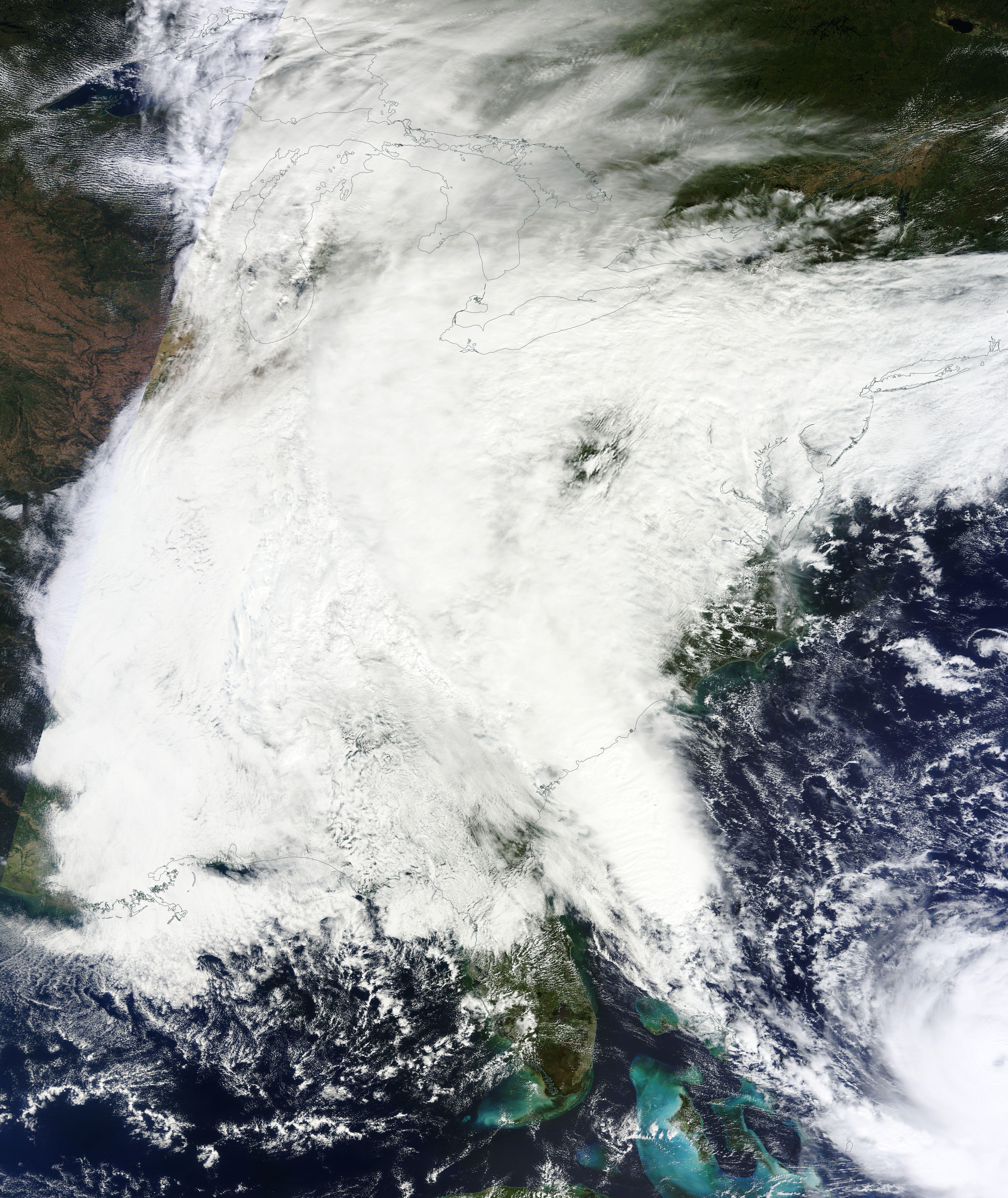
English: Terra MODIS satellite imagery of a nor'easter responsible for widespread flooding across the Southeastern United States and Hurricane Joaquin at 16:10z on October 3, 2015. |
| Date | |
| Source | https://earthdata.nasa.gov/labs/worldview/ |
| Author | National Aeronautics and Space Administration |
Licensing edit
| This file is in the public domain in the United States because it was solely created by NASA. NASA copyright policy states that "NASA material is not protected by copyright unless noted". (See Template:PD-USGov, NASA copyright policy page or JPL Image Use Policy.) | ||
 |
Warnings:
|
File history
Click on a date/time to view the file as it appeared at that time.
| Date/Time | Thumbnail | Dimensions | User | Comment | |
|---|---|---|---|---|---|
| current | 01:59, 4 October 2015 | | 5,025 × 5,969 (4.31 MB) | Cyclonebiskit (talk | contribs) | User created page with UploadWizard |
You cannot overwrite this file.
File usage on Commons
The following page uses this file:
File usage on other wikis
The following other wikis use this file:
- Usage on en.wikipedia.org
- Usage on fr.wikipedia.org
- Usage on www.wikidata.org