File:Offa's Dyke Footpath on Blodwel Rock - geograph.org.uk - 526835.jpg
No higher resolution available.
Offa's_Dyke_Footpath_on_Blodwel_Rock_-_geograph.org.uk_-_526835.jpg (640 × 480 pixels, file size: 158 KB, MIME type: image/jpeg)
Captions
Captions
Add a one-line explanation of what this file represents
Summary edit
| Description |
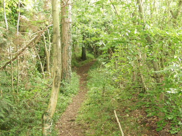
English: Offa's Dyke Footpath on Blodwel Rock Having climbed up from Llanymynech the Offa's Dyke Long Distance path goes around Llanymynech Quarry and Golf course to emerge onto Blodwel Rock. The woodland is part natural and part planted conifers. Shortly after this picture the path drops down the steep side of Blodwel Rock to Porth-y-waen. |
| Date | |
| Source | From geograph.org.uk |
| Author | John Haynes |
| Attribution (required by the license) | John Haynes / Offa's Dyke Footpath on Blodwel Rock / |
| Camera location | | View this and other nearby images on: OpenStreetMap |
|---|
_heading:202.00&language=en)
| Object location | | View this and other nearby images on: OpenStreetMap |
|---|
_heading:202.00&language=en)
Licensing edit

|
This image was taken from the Geograph project collection. See this photograph's page on the Geograph website for the photographer's contact details. The copyright on this image is owned by John Haynes and is licensed for reuse under the Creative Commons Attribution-ShareAlike 2.0 license.
|
This file is licensed under the Creative Commons Attribution-Share Alike 2.0 Generic license.
Attribution: John Haynes
- You are free:
- to share – to copy, distribute and transmit the work
- to remix – to adapt the work
- Under the following conditions:
- attribution – You must give appropriate credit, provide a link to the license, and indicate if changes were made. You may do so in any reasonable manner, but not in any way that suggests the licensor endorses you or your use.
- share alike – If you remix, transform, or build upon the material, you must distribute your contributions under the same or compatible license as the original.
File history
Click on a date/time to view the file as it appeared at that time.
| Date/Time | Thumbnail | Dimensions | User | Comment | |
|---|---|---|---|---|---|
| current | 16:57, 5 February 2011 | | 640 × 480 (158 KB) | GeographBot (talk | contribs) | == {{int:filedesc}} == {{Information |description={{en|1=Offa's Dyke Footpath on Blodwel Rock Having climbed up from Llanymynech the Offa's Dyke Long Distance path goes around Llanymynech Quarry and Golf course to emerge onto Blodwel Rock. The woodland is |
You cannot overwrite this file.
File usage on Commons
There are no pages that use this file.