File:Ohniste v kapli.jpg
Size of this preview: 337 × 600 pixels. Other resolutions: 135 × 240 pixels | 270 × 480 pixels | 431 × 768 pixels | 575 × 1,024 pixels | 2,248 × 4,000 pixels.
Original file (2,248 × 4,000 pixels, file size: 1.45 MB, MIME type: image/jpeg)
File information
Structured data
Captions
This image is blurry. It might therefore qualify for deletion if an identical image of better quality is provided.
Some pictures are blurred intentionally; those should not be deleted but placed in Category:Intentionally blurred images. |
Summary
editCamera location | 49° 37′ 50.59″ N, 14° 51′ 51.34″ E | View this and other nearby images on: OpenStreetMap | 49.630719; 14.864262 |
---|
DescriptionOhniste v kapli.jpg |
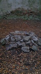
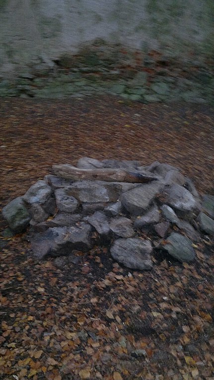
Čeština: Zakázané ohniště uvnitř kaple sv. Máří Magdaleny |
Date | |
Source | Own work |
Author | Eiram9 |
Permission (Reusing this file) |
I, the copyright holder of this work, hereby publish it under the following license: This file is licensed under the Creative Commons Attribution-Share Alike 3.0 Unported license.
|
File history
Click on a date/time to view the file as it appeared at that time.
Date/Time | Thumbnail | Dimensions | User | Comment | |
---|---|---|---|---|---|
current | 22:28, 6 December 2011 | 2,248 × 4,000 (1.45 MB) | Eiram9 (talk | contribs) |
You cannot overwrite this file.
File usage on Commons
There are no pages that use this file.
Metadata
This file contains additional information such as Exif metadata which may have been added by the digital camera, scanner, or software program used to create or digitize it. If the file has been modified from its original state, some details such as the timestamp may not fully reflect those of the original file. The timestamp is only as accurate as the clock in the camera, and it may be completely wrong.
Camera manufacturer | Nokia |
---|---|
Camera model | N8-00 |
Exposure time | 30,001/1,000,000 sec (0.030001) |
F-number | f/2.796875 |
ISO speed rating | 799 |
Date and time of data generation | 15:58, 30 October 2011 |
Lens focal length | 5.8984375 mm |
Latitude | 49° 37′ 50.59″ N |
Longitude | 14° 51′ 51.34″ E |
Altitude | 627 meters above sea level |
Orientation | Normal |
Horizontal resolution | 300 dpi |
Vertical resolution | 300 dpi |
File change date and time | 15:58, 30 October 2011 |
Y and C positioning | Centered |
Exif version | 2.2 |
Date and time of digitizing | 15:58, 30 October 2011 |
Meaning of each component |
|
APEX shutter speed | 5.058 |
APEX aperture | 2.96875 |
Light source | Flash |
Flash | Flash fired, auto mode |
DateTime subseconds | 021 |
DateTimeOriginal subseconds | 021 |
DateTimeDigitized subseconds | 021 |
Supported Flashpix version | 1 |
Color space | sRGB |
Custom image processing | Normal process |
Exposure mode | Auto exposure |
White balance | Auto white balance |
Digital zoom ratio | 1.07 |
Scene capture type | Standard |
Scene control | High gain up |
Measurement mode | 3-dimensional measurement |
Measurement precision | Fair (1.2) |
Geodetic survey data used | WGS-84 |
GPS tag version | 0.0.2.2 |