File:Old railway, Banbridge - geograph.org.uk - 175493.jpg
No higher resolution available.
Old_railway,_Banbridge_-_geograph.org.uk_-_175493.jpg (640 × 426 pixels, file size: 192 KB, MIME type: image/jpeg)
Captions
Captions
Add a one-line explanation of what this file represents
Summary
edit
| Description |
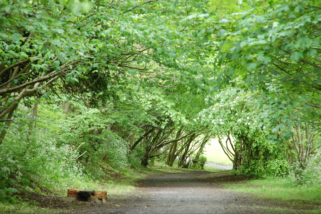
English: Old railway, Banbridge. The trackbed of the old railway from Banbridge to Scarva has been converted into a path. The photograph shows the path looking towards Scarva. Banbridge station was a few hundred yards behind the photographer. Continue to 260641. |
| Date | |
| Source | From geograph.org.uk |
| Author | Aubrey Dale |
| Object location | | View this and other nearby images on: OpenStreetMap |
|---|
_heading:315.00&language=en)
Licensing
edit

|
This image was taken from the Geograph project collection. See this photograph's page on the Geograph website for the photographer's contact details. The copyright on this image is owned by Aubrey Dale and is licensed for reuse under the Creative Commons Attribution-ShareAlike 2.0 license.
|
This file is licensed under the Creative Commons Attribution-Share Alike 2.0 Generic license.
Attribution: Aubrey Dale
- You are free:
- to share – to copy, distribute and transmit the work
- to remix – to adapt the work
- Under the following conditions:
- attribution – You must give appropriate credit, provide a link to the license, and indicate if changes were made. You may do so in any reasonable manner, but not in any way that suggests the licensor endorses you or your use.
- share alike – If you remix, transform, or build upon the material, you must distribute your contributions under the same or compatible license as the original.
File history
Click on a date/time to view the file as it appeared at that time.
| Date/Time | Thumbnail | Dimensions | User | Comment | |
|---|---|---|---|---|---|
| current | 14:33, 31 January 2010 | | 640 × 426 (192 KB) | GeographBot (talk | contribs) | == {{int:filedesc}} == {{Information |description={{en|1=Old railway, Banbridge. The trackbed of the old railway from Banbridge to Scarva has been converted into a path. The photograph shows the path looking towards Scarva. Banbridge station was a few hu |
You cannot overwrite this file.
File usage on Commons
There are no pages that use this file.