File:Oliphant Islands by Signy Island - South Orkney Islands, BAT.svg

Size of this PNG preview of this SVG file: 69 × 101 pixels. Other resolutions: 164 × 240 pixels | 328 × 480 pixels | 525 × 768 pixels | 699 × 1,024 pixels | 1,399 × 2,048 pixels.
Original file (SVG file, nominally 69 × 101 pixels, file size: 188 KB)
Captions
Captions
Add a one-line explanation of what this file represents
Summary edit
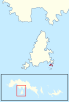
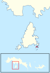
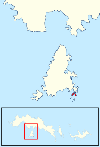
| Description | Location of the Oliphant Islands off Signy Island in the South Orkney Islands, in the British Antarctic Territory |
| Date | |
| Source | Data from British Antarctic Survey Geodata Portal - Antarctic Digital Database |
| Author |
British Antarctic Survey
|
| Permission (Reusing this file) |
This file is licensed under the Creative Commons Attribution 4.0 International license. Attribution: Antarctic Digital Database
|
File history
Click on a date/time to view the file as it appeared at that time.
| Date/Time | Thumbnail | Dimensions | User | Comment | |
|---|---|---|---|---|---|
| current | 15:30, 21 May 2022 | | 69 × 101 (188 KB) | Hogweard (talk | contribs) | Consistent line widths |
| 15:28, 21 May 2022 |  | 69 × 101 (188 KB) | Hogweard (talk | contribs) | == {{int:filedesc}} == {{Information |description=Location of the Oliphant Islands off Signy Island in the South Orkney Islands, in the British Antarctic Territory |date=2020-01-21 |source={{BAS data|source}} |author={{BAS data|author}} *Derivative work: {{u|Hogweard}} |permission={{BAS data}} |other versions= }} Category:Maps of the South Orkney Islands Category:Signy Island |
You cannot overwrite this file.
File usage on Commons
There are no pages that use this file.
File usage on other wikis
The following other wikis use this file:
- Usage on en.wikipedia.org