File:OpenStreetMap of Prestonville, Brighton.png
Size of this preview: 443 × 599 pixels. Other resolutions: 177 × 240 pixels | 355 × 480 pixels | 850 × 1,150 pixels.
Original file (850 × 1,150 pixels, file size: 704 KB, MIME type: image/png)
Captions
Captions
Add a one-line explanation of what this file represents
| Description |
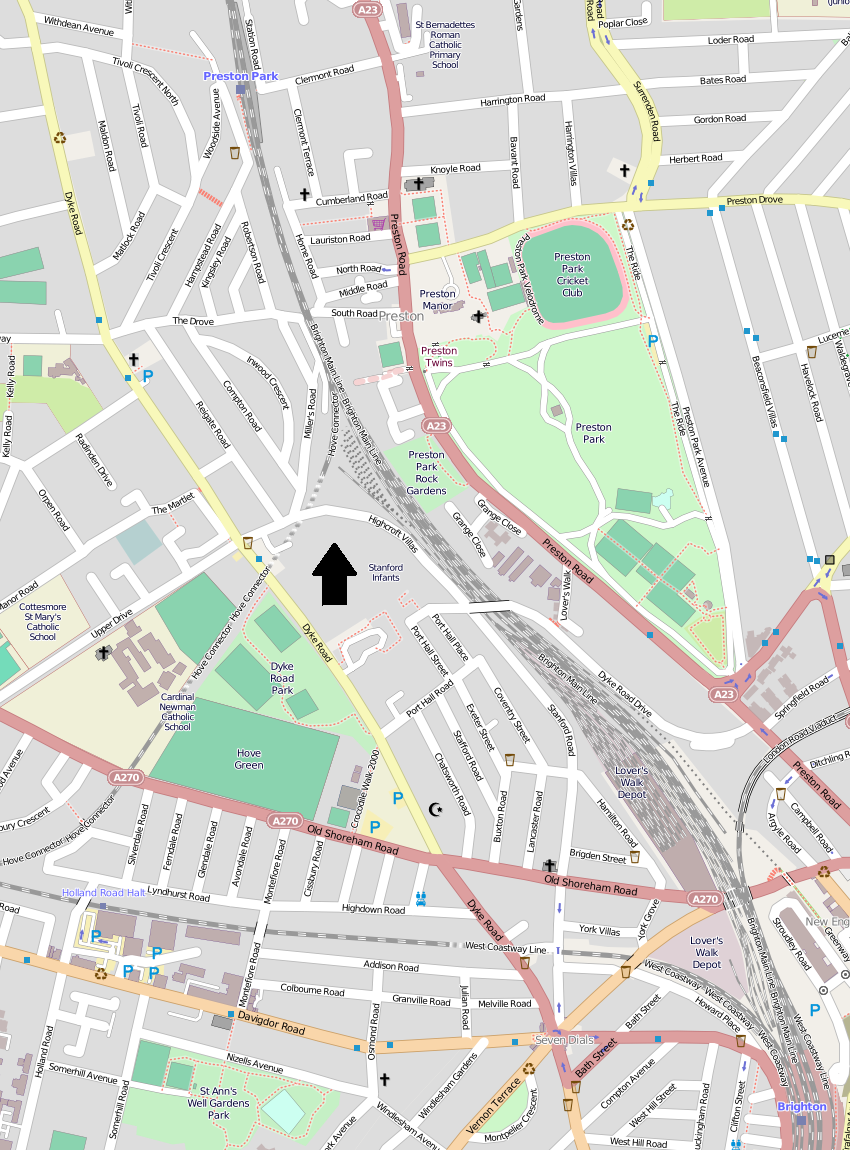
English: A map of the Prestonville area of Brighton, part of the English city of Brighton and Hove. The boundaries are Dyke Road, Tivoli Crescent North, Preston Park station, the London–Brighton railway line, Old Shoreham Road and Seven Dials. Derived from OpenStreetMap (permalink). North is indicated by the large arrow. |
| Date | |
| Source | OpenStreetMap |
| Author | Hassocks5489 |
| Other versions |
This file is licensed under the Creative Commons Attribution-Share Alike 2.0 Generic license.
- You are free:
- to share – to copy, distribute and transmit the work
- to remix – to adapt the work
- Under the following conditions:
- attribution – You must give appropriate credit, provide a link to the license, and indicate if changes were made. You may do so in any reasonable manner, but not in any way that suggests the licensor endorses you or your use.
- share alike – If you remix, transform, or build upon the material, you must distribute your contributions under the same or compatible license as the original.
File history
Click on a date/time to view the file as it appeared at that time.
| Date/Time | Thumbnail | Dimensions | User | Comment | |
|---|---|---|---|---|---|
| current | 21:30, 29 January 2015 | | 850 × 1,150 (704 KB) | Hassocks5489 (talk | contribs) | {{Information |Description={{en|1=A map of the Prestonville area of Brighton, part of the English city of Brighton and Hove. The boundaries are Dyke Road, Tivoli Crescent North, Preston Park station, the London–Brighton railway line, Old Shoreha... |
You cannot overwrite this file.
File usage on Commons
There are no pages that use this file.
File usage on other wikis
The following other wikis use this file:
- Usage on en.wikipedia.org