File:Operation25yu.jpg

Size of this preview: 689 × 599 pixels. Other resolutions: 276 × 240 pixels | 552 × 480 pixels | 883 × 768 pixels | 1,177 × 1,024 pixels | 1,775 × 1,544 pixels.
Original file (1,775 × 1,544 pixels, file size: 1.03 MB, MIME type: image/jpeg)
Captions
Captions
Add a one-line explanation of what this file represents
Summary edit
| Description |
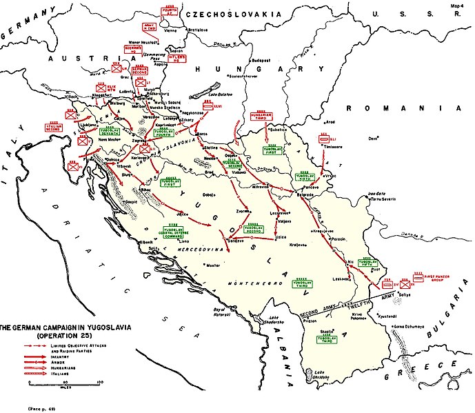
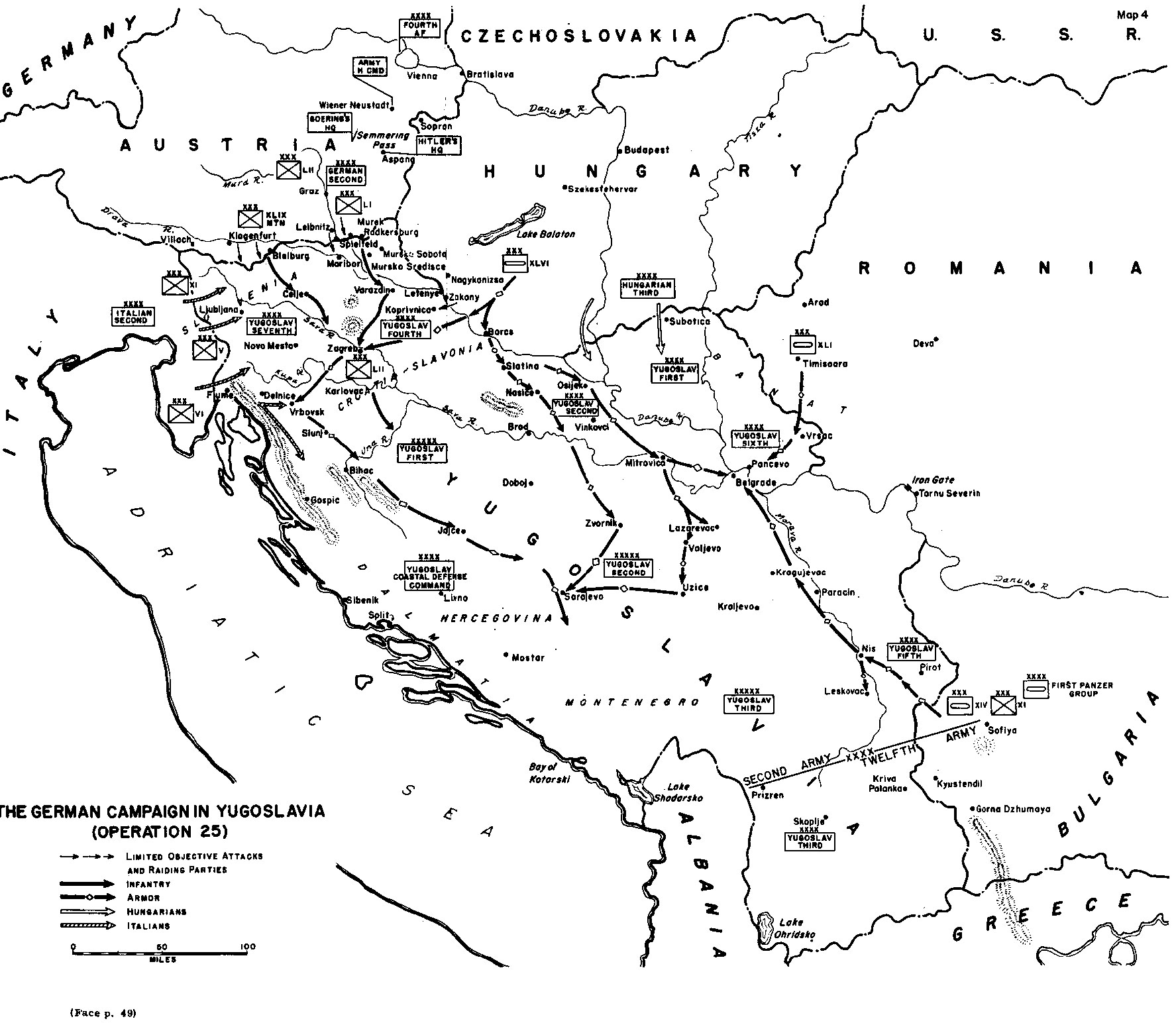
English: A black and white map showing the Axis invasion of Yugoslavia in April 1941
|
| Date | |
| Source | http://www.army.mil/cmh-pg/books/wwii/balkan/Maps/4.jpg |
| Author | US Army |

|
File:Map of invasion of Yugoslavia - Situation map.svg is a vector version of this file. It should be used in place of this JPG file when not inferior.
File:Operation25yu.jpg → File:Map of invasion of Yugoslavia - Situation map.svg
For more information, see Help:SVG. |
 |
Licensing edit
This file is a work of a U.S. Army soldier or employee, taken or made as part of that person's official duties. As a work of the U.S. federal government, it is in the public domain in the United States.
|
 |
derivative works edit
Derivative works of this file: InvasiónDeYugoslaviaAbrilDe1941.svg
File history
Click on a date/time to view the file as it appeared at that time.
| Date/Time | Thumbnail | Dimensions | User | Comment | |
|---|---|---|---|---|---|
| current | 13:34, 23 September 2017 | | 1,775 × 1,544 (1.03 MB) | Hohum (talk | contribs) | Darker red and green |
| 13:23, 23 September 2017 |  | 1,775 × 1,544 (1.03 MB) | Hohum (talk | contribs) | Use colours to clarify | |
| 11:14, 14 May 2006 |  | 1,775 × 1,544 (452 KB) | Orlovic (talk | contribs) | Unternhmen 25 Source: [http://www.army.mil/cmh-pg/books/wwii/balkan/Maps/4.jpg http://www.army.mil/cmh-pg/books/wwii/balkan/Maps/4.jpg] |
You cannot overwrite this file.
File usage on Commons
The following 11 pages use this file:
- Atlas of Bosnia and Herzegovina
- Atlas of Republika Srpska
- Atlas of Serbia
- Atlas of Slovenia
- Atlas of World War II
- Atlas of Yugoslavia
- User:J budissin/Uploads/BiH/2017 September 21-30
- User:Magog the Ogre/Maps of conflicts/2017 September
- File:InvasiónDeYugoslaviaAbrilDe1941.svg
- File:Map of invasion of Yugoslavia - Situation map.svg
- Category:Invasion of Yugoslavia
File usage on other wikis
The following other wikis use this file:
- Usage on ar.wikipedia.org
- Usage on bg.wikipedia.org
- Usage on bs.wikipedia.org
- Usage on ca.wikipedia.org
- Usage on de.wikipedia.org
- Usage on en.wikipedia.org
- Usage on fi.wikipedia.org
- Usage on fr.wikipedia.org
- Usage on hu.wikipedia.org
- Usage on it.wikipedia.org
- Usage on ja.wikipedia.org
- Usage on ko.wikipedia.org
- Usage on ms.wikipedia.org
- Usage on nl.wikipedia.org
- Usage on no.wikipedia.org
- Usage on pt.wikipedia.org
- Usage on ro.wikipedia.org
- Usage on ru.wikipedia.org
- Usage on sl.wikipedia.org
- Usage on sr.wikipedia.org
- Usage on ta.wikipedia.org
- Usage on uk.wikipedia.org
- Usage on vi.wikipedia.org
- Usage on www.wikidata.org